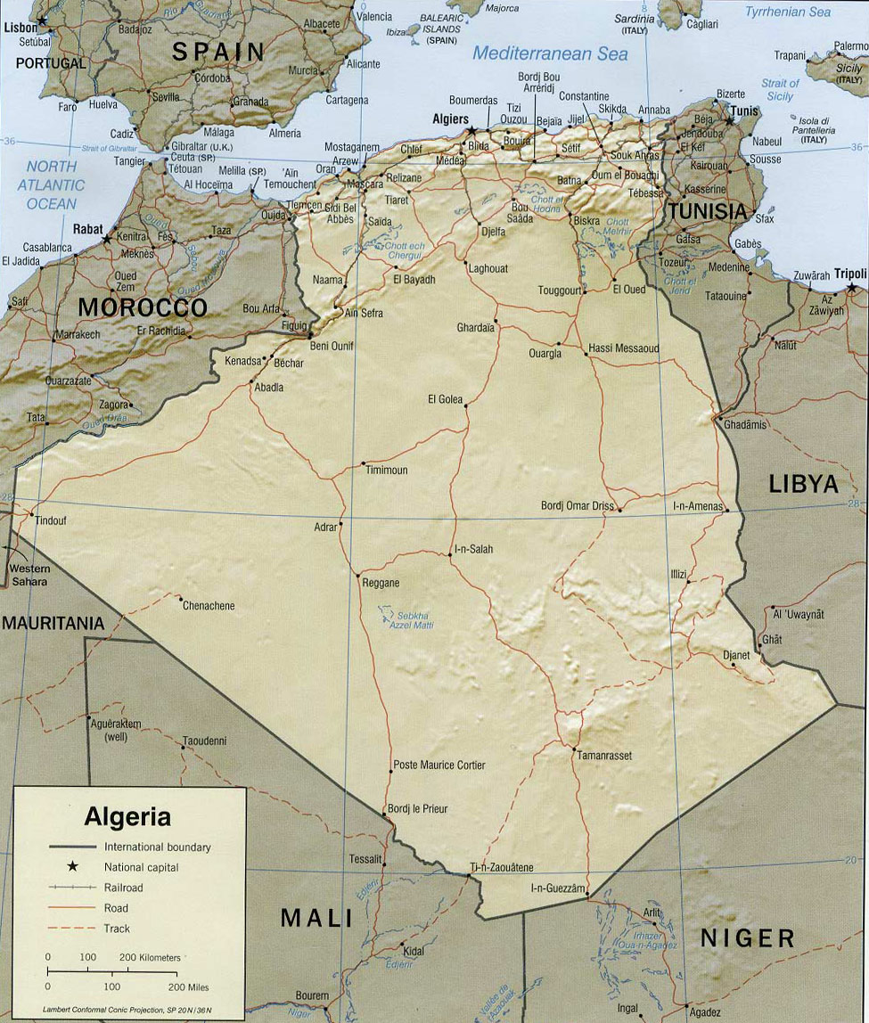
Map of Algeria
The Popular Republic of Algeria is a country in northwestern Africa that borders the Mediterranean Sea. It is the largest country on the African continent and the Sahara desert spreads over nine-tenths of it. Coastal plains lie near the Mediterranean coast, separated by mountains from the Sahara. Algiers, along the Mediterranean coast, is the country’s capital and largest city. The overwhelming majority of Algeria’s people live in the northern part of the country, near the coast.
Algeria was a colony of France from the mid-19th century until it won independence in 1962. Today, it is one of the wealthier countries in Africa, largely because of its petroleum reserves.
Border with Mali, Niger, Mauritania, Morocco, Tunisia and Libya.
Beach used by tourists west of Algiers, the capital.

◄ Africa
|
|
Copyright © Geographic Guide - Travel, African Continent. |
Algeria
Map: U.S. Central Intelligence Agency.

