Himalayas and The Everest
Mount Everest
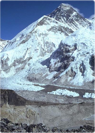
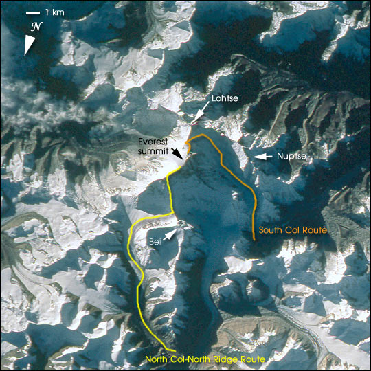
Mount Everest is the highest (8850 m) mountain in the world. This detailed look at Mt. Everest and Lohtse (below) is part of a more extensive photograph of the central Himalaya taken in October 1993 that is one of the best views of the mountain captured by astronauts to date. It shows the North and South Faces of Everest in shadow with the Kangshung Face in morning light. Other major peaks in the immediate area are Nuptse and Bei Peak (Changtse). Everest holds a powerful fascination for climbers and trekkers from around the world. The paths for typical North and South climbing routes are sketched on the image below (NASA).
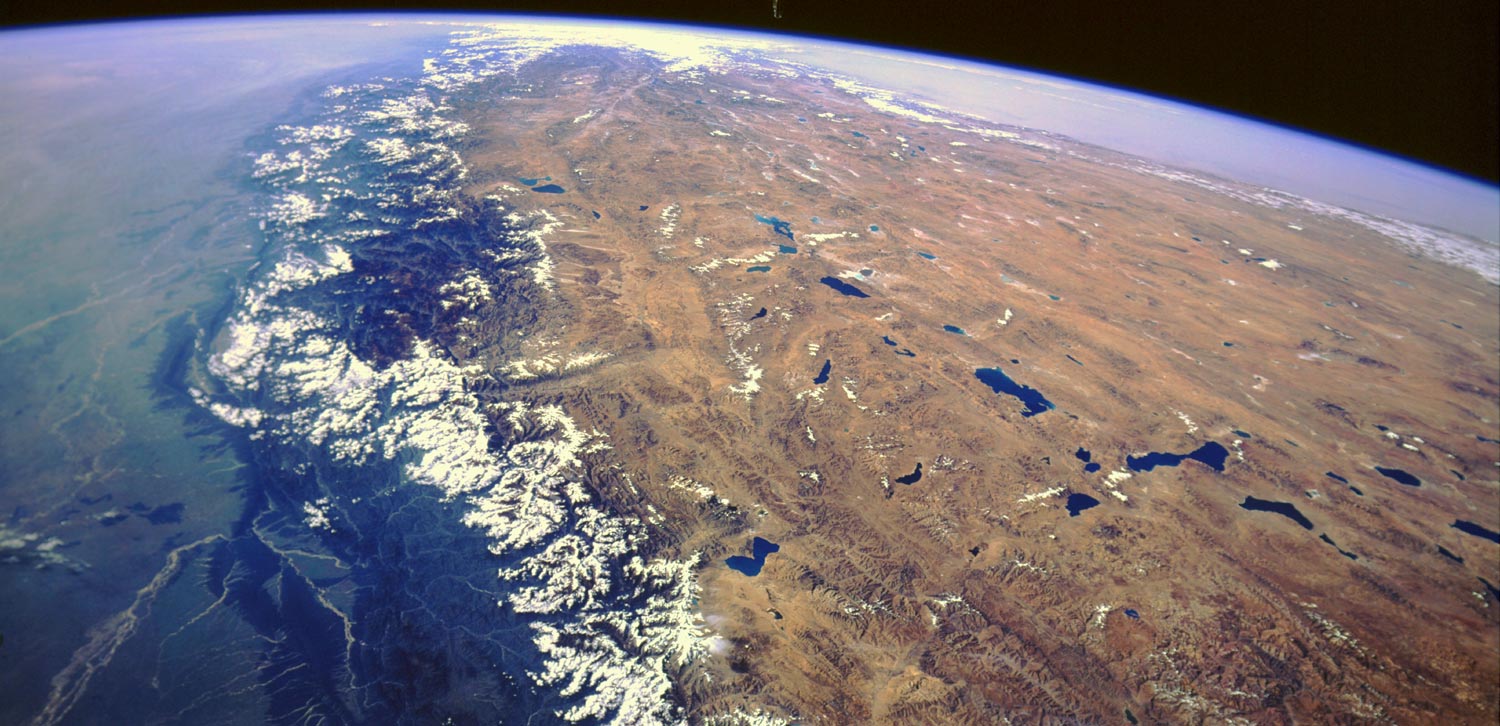
The Himalayas and the Tibetan Plateau (also known as the Qinghai-Xizang Plateau) shown in this photograph (below) were formed and continue to be modified by the convergent collision of two of the world's great continental tectonic plates, the Eurasian and the Indian-Australian. As a result of this collision that started more than 65 million years ago, the average elevation of the Tibetan Plateau (shades of brown and numerous deep blue lakes) in the intermountain valleys is approximately 4880 m. The lakes are fed by the snowmelt from the higher mountain ridges and peaks. Words like treeless, cold, barren, windswept, and desolate are good descriptors of the harsh environment that exists on this elevated plateau. Part of the highest mountains in the world, sometimes called the "rooftop of the world," the Himalayas create a formidable barrier southwest of the Tibetan Plateau. The snowcapped Himalayas trend in a southeast-northwest arc with more than 30 peaks rising to heights of more than 7300 m. Some clouds along the lower foothills on the southwest side of the Himalayas and some snowcapped mountain ridges and peaks are visible in the photograph. Toward the horizon, hazy and dusty conditions seem to exist on the Indo-Gangetic Plain of northern India (southwest) and the Takla Makan Desert of western China (NASA).
Himalayas and The Everest
|
|
Copyright © Geographic Guide - Travel. |