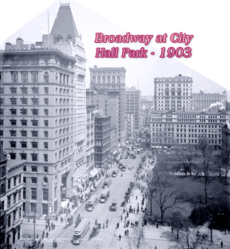
Broadway at City Hall Park
In the 17th century, the area that is now City Hall Park was known as "Vlackte" by the Dutch settlers ("Plain" in English) and the Common or Flats by the English. It was a public land until 1686, when the Dongan Charter established it as property of the City of New York.
The land to the west side of the Common to Hudson River was part of the Dutch West India Company's Farm. After 1664, when the English forces took control of New Amsterdam, this land became the Duke's Farm (1664-1674), later King's Farm (1674-1702) and Queen's Farm (1702-1705). In 1705, this land was granted by Queen Anne to the Trinity Church and became known as the Church Farm.
Buildings on the west side of present-day Broadway at City Hall Park, between Vesey Street and Chambers Street, began to be constructed about the mid 18th century, except for a farm house, which stood north of present-day Vesey Street since 1720 or 1719 (see David Grim's 1742 map). At the time, Broadway did not go north from that farm house. There was a rope-walk instead, established in 1718, between about present-day Park Place and Barclay Street. Broadway, however, continued to the "High Road to Boston", present-day Park Row, as recorded on James Lyne's 1730 manuscript map, on which a building was drawn at the junction of the two roads.
According to Stokes (Iconography of Manhattan Island, ...1915), the various tenants of the old farm-house, referred above, were successively John Ryerson, Francis Ryerson (1720), Robert Harrison (1721), Mr. Balm, Cornelius Cozine and Adam Vandenberg. The house was long kept as the Drovers' Inn. In connection with the tavern business, were also a public garden and place of amusement. It seems Vandenberg was still in the occupation of the premises in 1770.
About the mid-18th century, part of the Church Farm was laid out into building lots (see Duyckinck Map, 1755) and a rural road, extension of Broadway, was laid to near Anthony Rutger’s Farm, where Ranelagh Gardens was established in 1765. The following years, Trinity Church leased the lots on this area and houses were built.
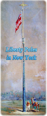
The first house erected in the Common (east side Broadway) was the John Harris house, built in the 1720s. In the second half of 18th century, the area near John Harris house was used to erect the Liberty Poles.
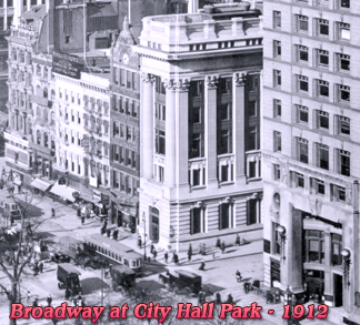
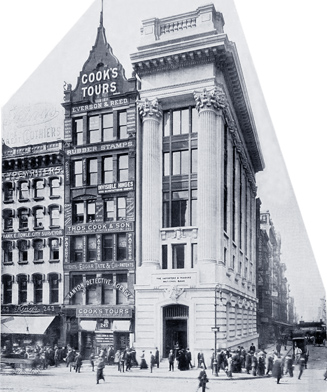
In 1754, Mr. Kuysick was a tavern-keeper on the corner of Murray Street (now 253 Broadway), which became later Montagne's Tavern. The site is now occupied by the Postal Telegraph Company Building, constructed between 1892 and 1894.
In 1756, Samuel Fraunces established his Mason's Arms Tavern on the southwest corner of Broadway and Warren Street. It was renamed Hamden Hall, in 1770. In 1854, a five-story neoclassic building was completed on the site. In April 1900, the Rogers, Peet & Company building was completed on the site. It was designated a New York landmark in 2010.
Both Mason's Arms and Montagne's Tavern were involved in the Liberty Poles conflicts, between 1767 and 1770.
In June 1760, a plan of a street from about present-day Ann Street (then Spring Garden House) to Astor Place (then Widow Rutgers) was delivered by Francis Maerschalck to the Common Council. Trinity Church ceded the street to the City in 1761. It was an extension of Broadway of the time, but it was named later the Great George Street. The first part was constructed before 1767, until about present-day Duane Street, but many people called it "Broadway". The name Great George Street appeared, for example, in the Plan of the Ground Contiguous to the Poor House, surveyed in 1774, by Gerard Bancker and in the Plan of McComb and Tiebout (1789).
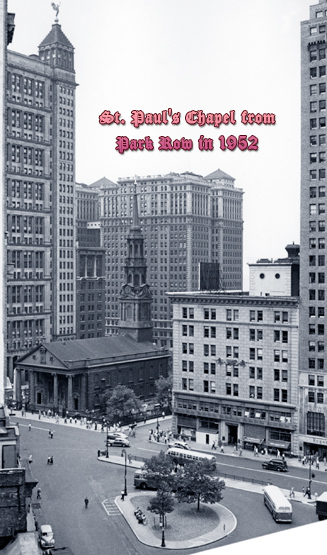
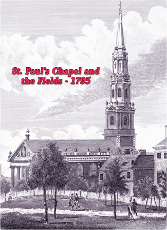
The first temple of St. Paul's Chapel was built between 1764 and 1766, on the southern side of Vesey Street. It was destroyed in the Great Fire of 1776. The second temple was built by 1790.
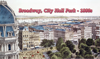
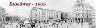
In May 1793, the Common Council approved the paving of Great George Street from Vesey Street to Murray Street. The same year, measures were taken to extend Great George Street from near Duane Street to more than a mile further north. In 1794, Great George Street was officially renamed Broadway. In 1805, the Common Council ordered that Broadway along the Park be paved. By 1820, this section of Broadway had become a shopping destination for the New York's fashionable elite.
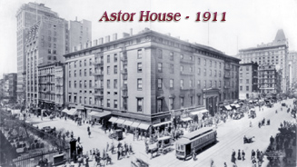
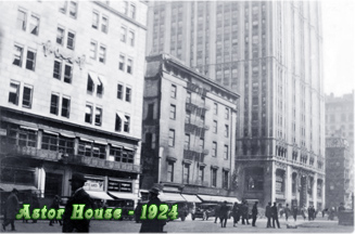
In 1836, the Astor House, a luxury hotel, was completed between Barclay Street and Vesey Street, occupying the entire block front. It was demolished in the early 20th century.
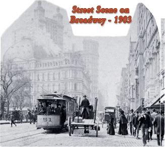
Asphalt pavement was laid down in 1900.
More: Broadway at City Hall Park in 19th Century ►
The 44-story Transportation Building, at 225 Broadway, on the northwest corner of Barclay Street, was completed in 1927, on part of the site of the old Astor House.
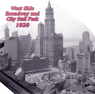
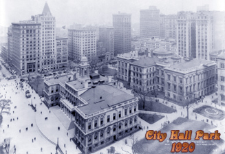
The City Hall Subway Station opened on October 27, 1904.
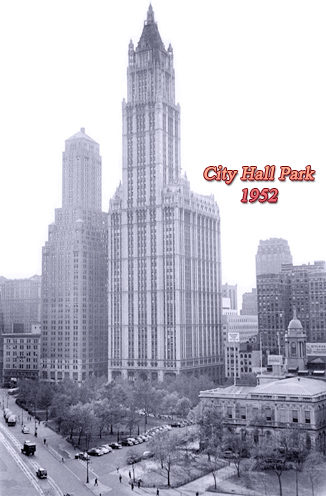
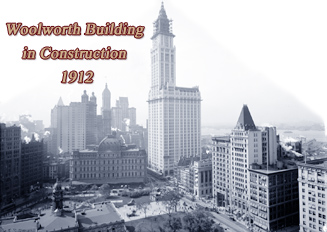
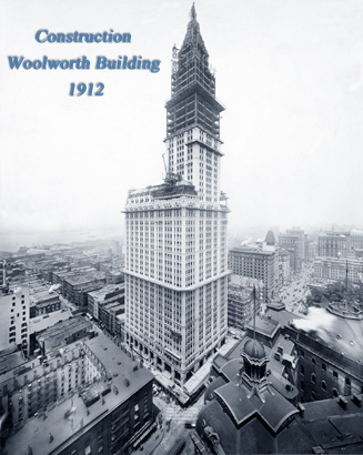
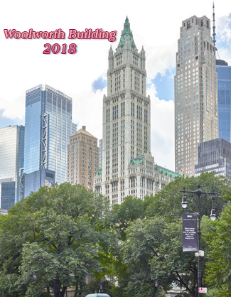
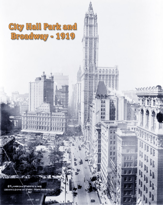
The 57-story Woolworth Building was erected between 1910 and 1913, at 233 Broadway, between Park Place and Barclay Street. It was the highest building in the world for about 17 years.
More: Park Row in 19th Century ►

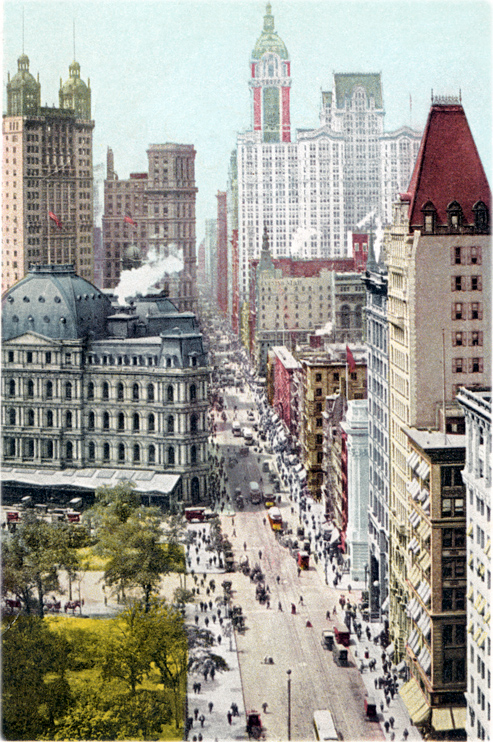
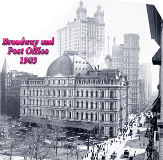
Vintage postcard showing Broadway with City Hall Park in the foreground and the Post Office Building on the left (copyright 1908 by Detroit Publishing Co. / source: New York Public Library).
Home Life and Postal Telegraph buildings - 1910.
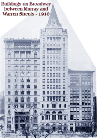
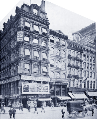
Buildings on Broadway at Murray Street - 1910.
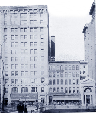
Office buildings on Broadway at Park Place - 1910.


Buildings on Broadway between Barclay Street and Park Place. They were razed for the Woolworth Building - 1910.
The opposite view, looking south.
Broadway between Warren and Chambers streets, 1910. The 12-story 261 Broadway, on the left, was erected about 1906.

Broadway at City Hall Park
By Jonildo Bacelar, Geographic Guide editor, September 2023.
|
Copyright © Geographic Guide - Antique images of NYC. Historic Places. |