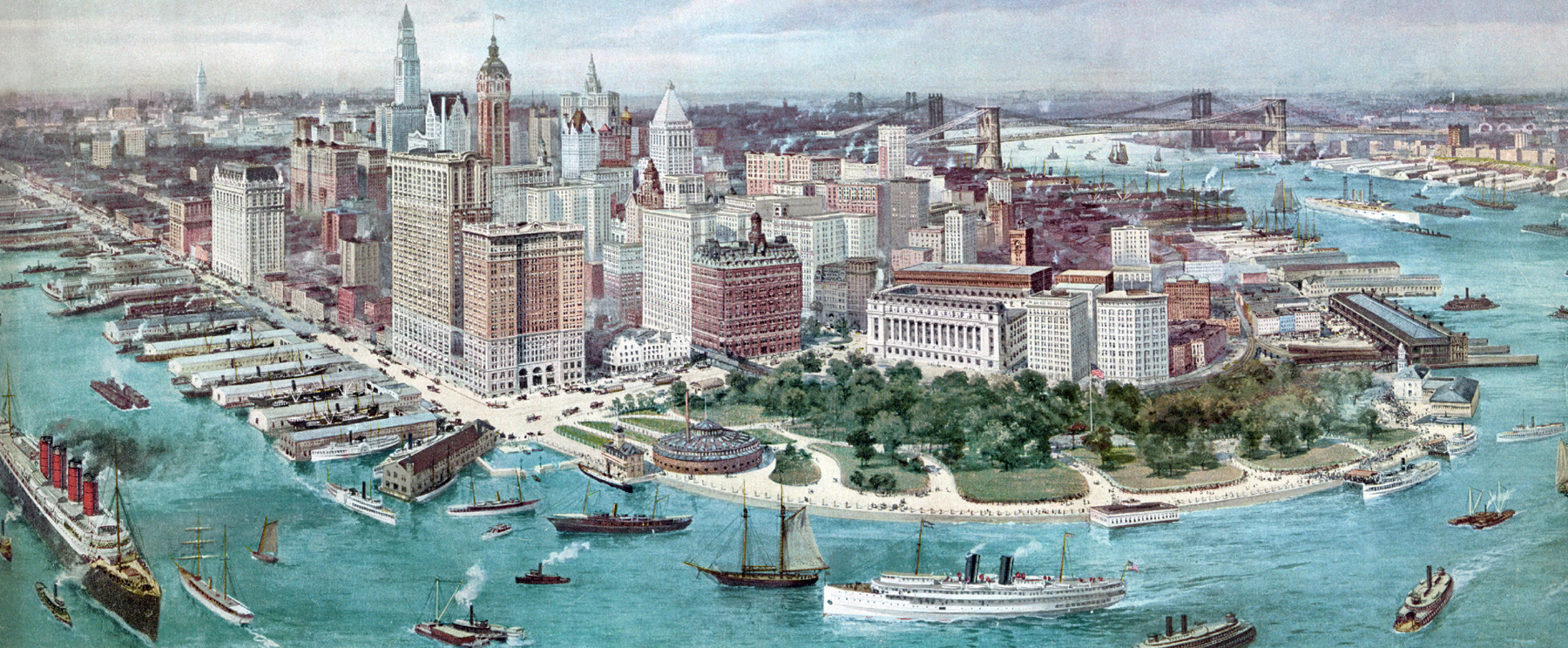
Lower Manhattan, Aerial View - 1912
Original title: Birdseye View of Lower Manhattan. Cityscape drawn by Richard W. Rummell (1848-1924), chromolithograph copyrighted 1911. Note: it inaccurately depicts a mixed cityscape between 1911 and late 1912, when the Woolworth Building and the Municipal Building had topped out. Both buildings, however, were completed in 1913. The Woolworth Building was the tallest building in the world until 1930, when it was surpassed by 40 Wall Street.
The City's total population in 1910 was 4.8 million people and grew to 5.6 million in 1920. Hudson River is to the left. The Battery and Bowling Green are in the foreground, crossed by the elevated railroad. The 47-story Singer Building was the tallest building in the world, from 1908 to 1909, when it was surpassed by the Metropolitan Life Insurance Company Tower.
Old Equitable Building, located at 120 Broadway, between Cedar Street and Pine Street, was destroyed by fire in 1912. A new 40-story Equitable Building, was constructed on the same site. By August 16, 1914, the structure had topped out at 38 stories above the ground level (not seen here). The building was completed on February 1, 1915.
This is the richest business section of the world, a financial center of reference. The World War I began in 1914, when the U.S. economy was in recession. Then followed an economic boom from 1914 to 1918. Europeans began buying more U.S. goods for war, and later, when the United States itself joined the battle, enormous U.S. federal spending shifted national production of goods civilians for war goods.
More: Historical maps of New York City ►

Pier A

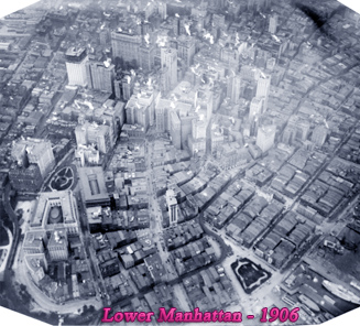
Lower Manhattan, Aerial View - 1912
|
Copyright © Geographic Guide - 20th Century NYC. Aerial Views. |