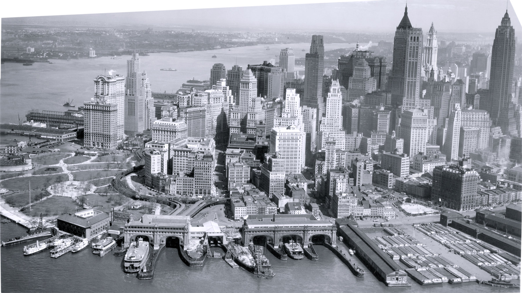
Lower Manhattan - 1938
Aerial photo of the Lower Manhattan, City of New York, dated April 19, 1938. Source: Mitchel Field, N.Y., Records of the Army Air Forces, National Archives at College Park, MD.
The Hudson River is above Manhattan, in the photo, and New Jersey is on the other side of the river. Battery Park is on the left and the East River is to the right. Most of the skyscrapers seen in the photo were erected in the first decades of the 20th century.
The old South Ferry terminal and the elevated station are in the foreground. Two tracks came from the combined 2nd and 3rd avenue lines, and two from the 6th and 9th avenue lines (which ceased operation in 1940 south of 145th Street), forming four tracks at the South Ferry terminal, with platforms outside and between each pair of tracks.
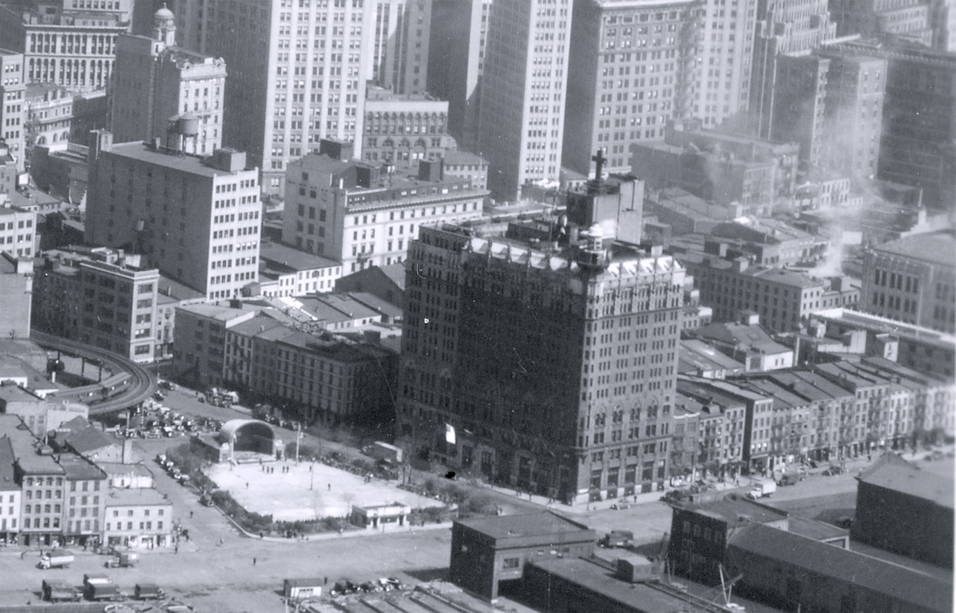
On the right, enlargement of the Jeanette Park, Coenties Slip and South Street.
Lower Manhattan - 1938
|
Copyright © Geographic Guide - 20th Century NYC Skyscrapers. |