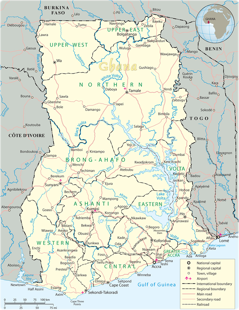
Map of Ghana
The Republic of Ghana is a multiethnic country in West Africa. By the 12th century, the gold trade started to boom in Bono (Bonoman) state in what is today southern Ghana, and it became the genesis of the Akan people's power and wealth in the region. Beginning in the 15th century, the Portuguese, followed by other European powers, arrived and competed for trading rights. In the 18th century, Asante was a highly organized, powerful and wealthy state, which provided enslaved people for the Atlantic slave trade, and in return received firearms that facilitated its territorial expansion. The Asante resisted increasing British influence in the coastal areas, engaging in a series of wars during the 19th century before ultimately falling under British control. Formed from the merger of the British colony of the Gold Coast and the Togoland trust territory, Ghana in 1957 became the first Sub-Saharan country in colonial Africa to gain its independence.
The capital is Accra. This African country has borders with Togo, Côte d'Ivoire and Burkina Faso. It is divided into 16 regions; Ahafo, Ashanti, Bono, Bono East, Central, Eastern, Greater Accra, North East, Northern, Oti, Savannah, Upper East, Upper West, Volta, Western and Western North (political map above).
◄ Africa

|
Copyright © Geographic Guide - Travel African Continent. |

Map of Ghana
