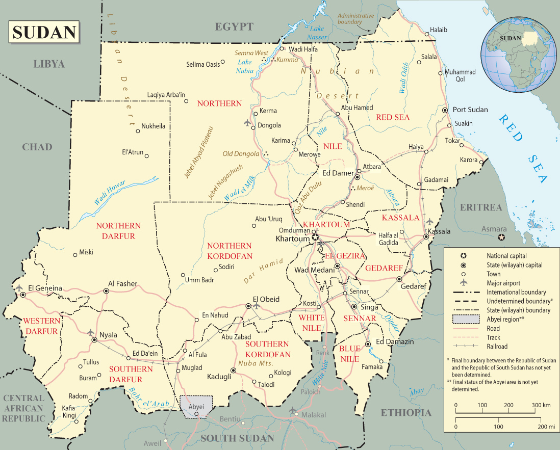
Map of Sudan - Africa
Source: United Nations (edited).
The present-day Sudan was the site of the Kingdom of Kerma (ca. 2500-1500 B.C.). The region was long referred to as Nubia, until it was absorbed into the New Kingdom of Egypt. By the 11th century B.C. The Kingdom of Kush gained independence from Egypt and it lasted in various forms until the middle of the 4th century A.D. After the fall of Kush, the Nubians formed three Christian kingdoms of Nobatia, Makuria, and Alodia, with the latter two enduring until around 1500. Between the 14th and 15th centuries, Arab nomads settled much of Sudan, leading to extensive Islamization between the 16th and 19th centuries. Following Egyptian occupation early in the 19th century, an agreement in 1899 set up a joint British-Egyptian government in Sudan, but it was effectively a British colony.
Military regimes favoring Islamic-oriented governments have dominated national politics since Sudan gained independence from Anglo-Egyptian co-rule in 1956. During most of the second half of the 20th century. The first civil war ended in 1972, but another broke out in 1983. Peace talks gained momentum in 2002-04, and the final North/South Comprehensive Peace Agreement in 2005 granted the southern rebels autonomy for six years, followed by a referendum on independence for South Sudan, it became independent in 2011. Sudan has also faced conflict in Darfur, Southern Kordofan, and Blue Nile starting in 2003.
◄ Africa

|
Copyright © Geographic Guide - Travel and Maps, African Continent. |


Map of Sudan - Africa