
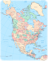
Alaska and Bering Sea
Alaska is the northernmost and westernmost state of the U.S.A., it is also the largest state of the Union. It is separated from Asia by the 82-km wide Bering Strait. Alaska was bought from Russia in 1867. Juneau is the capital and Anchorage is the largest city. In America, it is bordered by the Canadian Territory of Yukon and the province of British Columbia.
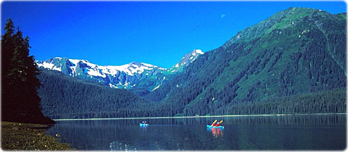
Windfall Harbor, Admiralty Island, in Alaska.

|
Copyright © Geographic Guide - Travel, American Continent. |
Source (edited): USGS National Map.
Alaska and Bering Sea