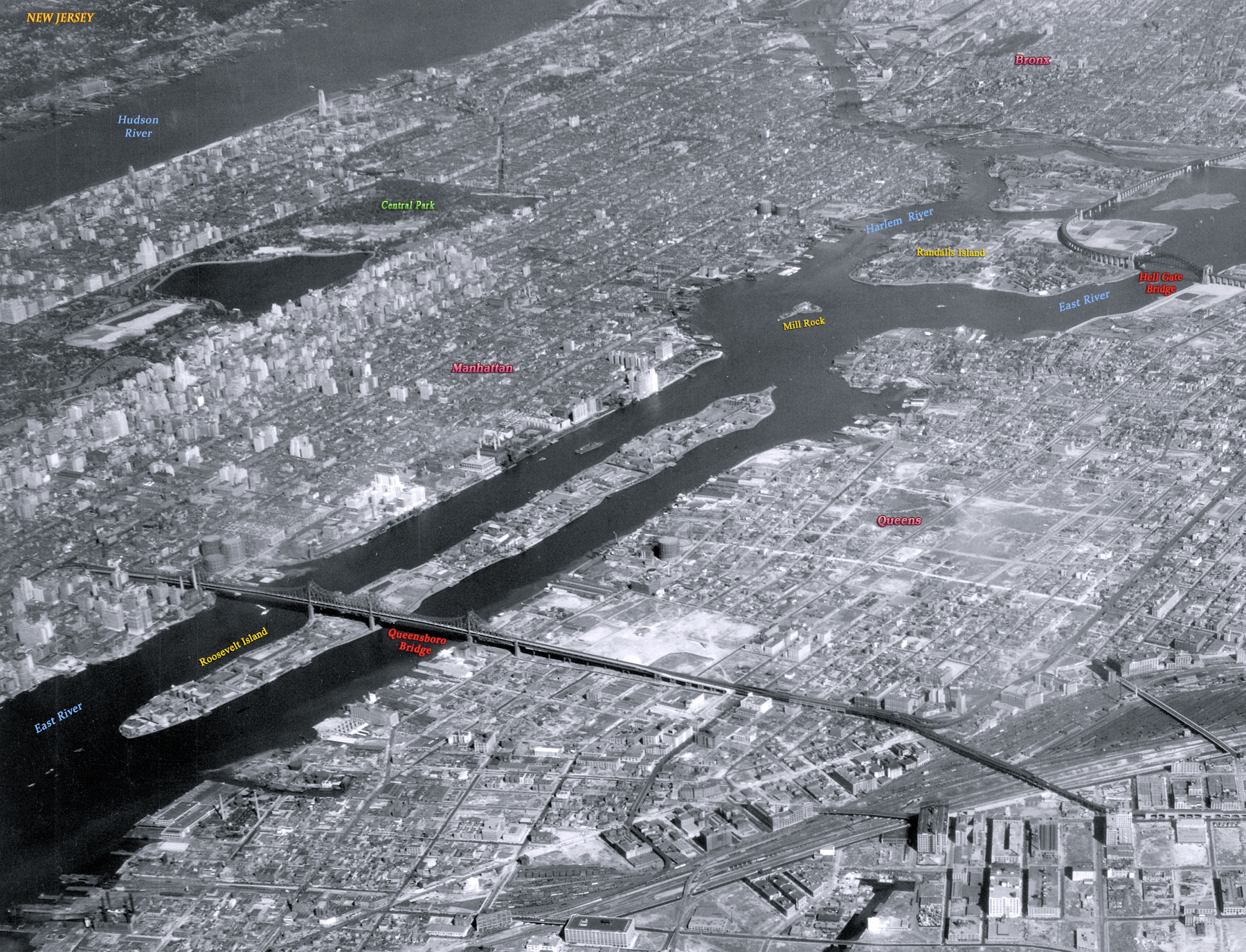
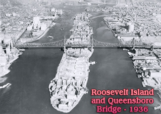
Roosevelt Island and Queensboro Bridge over East River - 1930
Welfare Island (former Blackwell's Island, now Roosevelt Island) and Queensboro Bridge over East River, New York City, looking northwest. Photo dated October 2, 1930. Source: Langley Field, Records Army Air Forces, U.S. National Archives and Records Administration (with additional text).
The Roosevelt Island is an island in the East River (a saltwater estuary) within the borough of Manhattan. The Queensboro Bridge opened to traffic in 1909, connecting East 59th Street in Manhattan to Queens. The island cannot be accessed directly from the bridge. Today, vehicular traffic uses the Roosevelt Island Bridge from Astoria, Queens. In 1973, Welfare Island was renamed Roosevelt Island.
The Hell Gate bridge is on right.


|
Copyright © Geographic Guide - 20th Century NYC. Island of the Borough of Manhattan. |
Roosevelt Island and Queensboro Bridge over East River - 1930