Amazon Rainforest
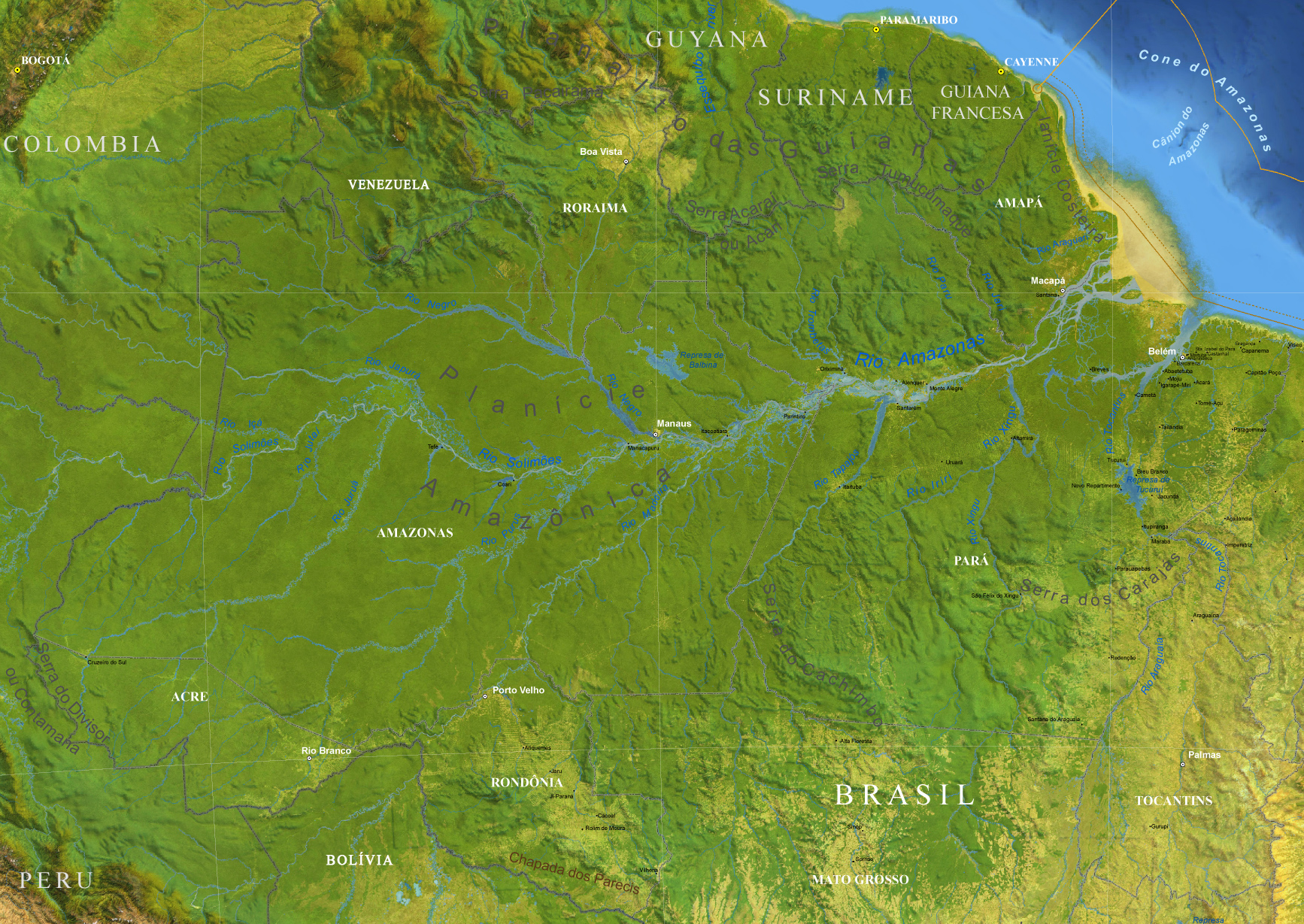
The Amazon is the region formed for the basin of the Amazon River and covered by the Amazonian Forest. It is the biggest equatorial forest of the world. The Great Amazon encloses nine countries of South America and an area of 7,5 million km². The Brazilian area represents 66% of this total. The Amazon River, alone, represents about 17% of all the liquid water of the world. It drains one-third of South America.
When the European pioneers arrived in the Amazon, in the 16th century, it was inhabited for a great population of aboriginals. In the beginning of the 20th century, it started a wild deforestation and, today, the ecological balance of the whole Amazon is at risk.
|
Copyright © Geographic Guide - Travel South America. |
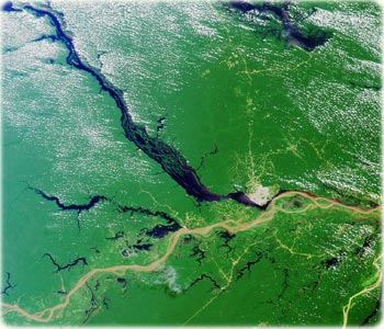
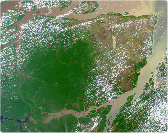
This image was acquired on July 23, 2000. Close to the city of Manaus (capital of the Amazonas State), Brazil, the Rio Solimões and the Rio Negro converge to form the Amazon River. Manaus is the gray patch to the right of image center.
The pale, murky color of the Rio Solimões heralds its burden of glacial silt and sand, which results from its origin in the Peruvian Andes mountains. The dark color of the Rio Negro is characteristic of clear waters that originate in areas of basement rock and carry little sediment. East of Manaus the pale and dark waters flow side-by-side as distinct flows before they eventually merge.
Northwest of Manaus on the Rio Negro is the Anavilhanas Archipelago, the largest group of freshwater islands in the world and a wildlife reserve. At the top of the image, a portion of the dark-colored Uatuma River is visible. In the lower right is the very light-colored Rio Madeira, formed from mountain streams originating near the Brazil-Bolivia border. Madeira is Portuguese for wood, and the river is named for the large amount of driftwood that floats on its waters (NASA).
Image base (edited): IBGE, Marinha do Brasil, NASA and USGS.
More in Brazil
Marajó island in the mouth of the Amazon River (satellite images from NASA).
◄ Brazil