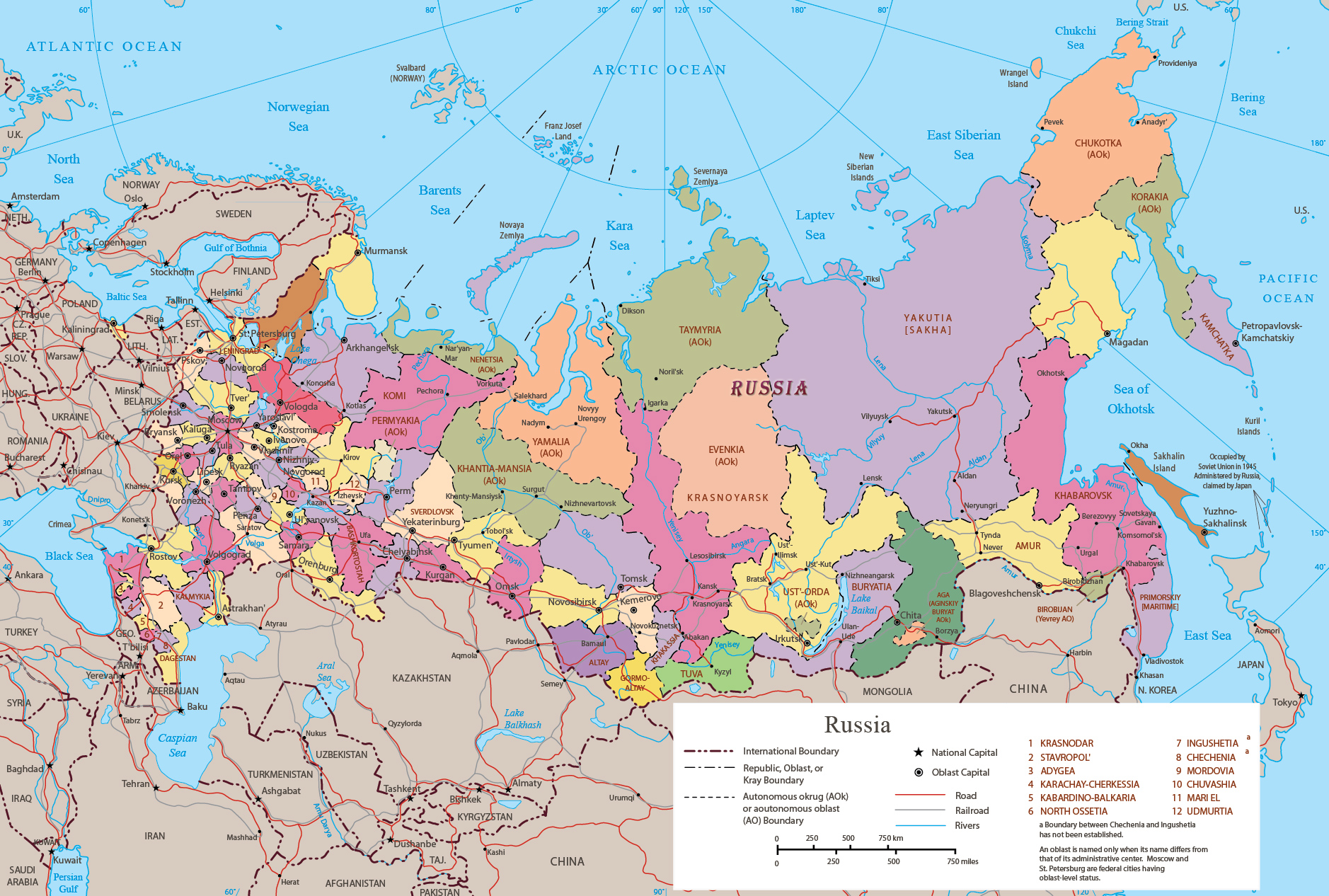
Political Map of Russia


|
Copyright © Geographic Guide - Travel European Continent. |
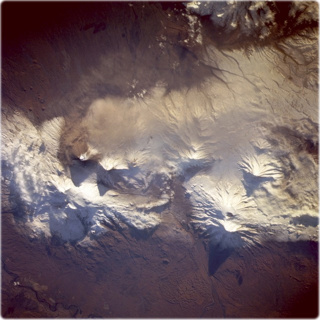
Klyuchevskaya Volcano, Kamchatka Peninsula, Russia. Klyuchevskaya Volcano erupted with lava and ash explosions only 2 days before this near-vertical photograph was taken October 3, 1994 (NASA). The landscape does not appear to have been much affected by the large quantity of ash that was spewed into the atmosphere. Collateral information obtained from the Smithsonian Institution Global Volcanism Network indicated that the eruption was still in progress at the time this photograph was taken but, obviously, at a greatly reduced rate compared to the earlier eruption in which the gas and steam plume rose to an estimated height of 1 km above the crater and was dispersed to the south for approximately 5 km. Lengthy shadows are cast from several adjacent stratovolcanoes. The summit of Tolbachinskiy Volcano at 3680 m above sea level is prominent southwest of Klyuchevskaya. A small segment of the meandering Kamchatka River is visible along the northwestern edge of the photograph.