Map of Mauritius
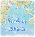
Mauritius is an independent island in the Indian Ocean. The country includes the island of Mauritius, the island of Rodrigues, the Agalega Islands and the Cargados Carajos Shoals. The country has a total area of 2,040 km². Port Louis is the capital and largest city.
The island of Mauritius is of volcanic origin. The south is mostly mountainous, rising to a maximum elevation in Piton de la Petite Rivière Noire (828 m). Several lakes are located in the plateau region, and numerous streams rise in the highlands and radiate to the coast. The island is surrounded by coral reefs, but Port Louis has a fine harbor. The climate is tropical and generally humid. The average annual temperature is 23°C on the coast but is lower in the central plateau. Strong cyclonic storms occur often during the hot season (December to April). The main natural resource is the relatively fertile soil of the island.
The economy of Mauritius has traditionally been dominated by sugarcane. Other crops include tea, peanuts, tobacco, and vegetables. Manufactures include refined sugar and sugar by-products, fertilizers, beverages, electronic components, and leather goods. The clothing and textile industry boomed during the 1980s, and tourism is increasingly important.
Although it has been settled for less than 400 years, Mauritius was probably visited by the Arabs before the 10th century, the Malays in the 1400s, and the Portuguese in the early 1500s. It was occupied in 1598 by the Dutch, who named it for Maurice of Nassau, then stadtholder of The Netherlands. The Dutch left in 1710, and in 1715 the French took possession, renaming it Île de France. It was captured by the British in 1810 during the Napoleonic Wars and was formally ceded to Britain in 1814. To offset the labor problem arising from abolition of slavery in the British Empire, the planters were allowed to import indentured laborers from India, and since 1861 the population has been mainly Indian. Mauritius was granted independence in 1968. From 1968 through 1991, Mauritius was a constitutional monarchy. In March 1992, it became a republic, under a new constitution.
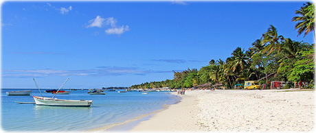
Beach in Mauritius

|
|
Copyright © Geographic Guide - Travel. |
Romeo design