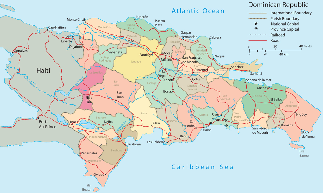
Political Map of the Dominican Republic
Dominican Republic is a country in the West Indies, occupying the eastern two-thirds of the island of Hispaniola. The country of Haiti occupies the western third of the island. The 315 km frontier with Haiti also marks a cultural divide.
The Dominican Republic was a colony of Spain for about three centuries, and most of its people are of mixed Spanish and African descent. Dominicans speak Spanish and follow many Spanish traditions. The people of Haiti, by contrast, are primarily of African descent and French in their traditions. The name of the Dominican Republic in Spanish is República Dominicana.
Below, a country house in Altos De Chavon, Dominican Republic.

|
Copyright © Geographic Guide - Travel American Continent. |