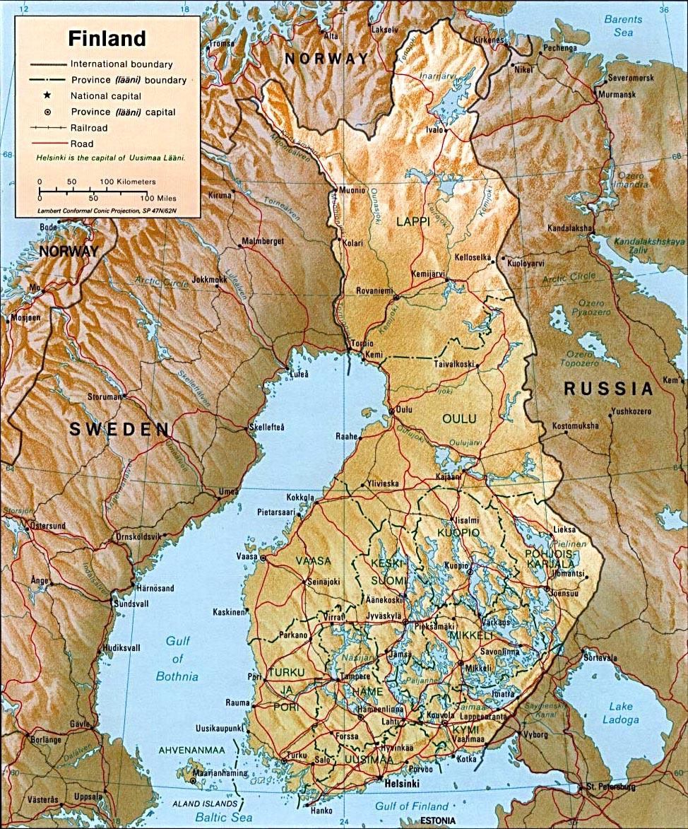
Map of Finland
 Most of Finland is flat. Low hills that rise across the
central and southern interior rarely exceed 300 m. Finland’s highest elevations
are in the northwest. Haltiatunturi, a peak in the far northwest near the border
with Norway, rises to a height of 1,328 m. The
northernmost regions of Finland, which lie within the Arctic Circle, make up a
part of Saamiland.
Most of Finland is flat. Low hills that rise across the
central and southern interior rarely exceed 300 m. Finland’s highest elevations
are in the northwest. Haltiatunturi, a peak in the far northwest near the border
with Norway, rises to a height of 1,328 m. The
northernmost regions of Finland, which lie within the Arctic Circle, make up a
part of Saamiland.
Finland’s coastline is low, rocky, and deeply indented by small bays and inlets. Most of Finland’s major cities and cultivated land lie along the nation’s coastal plain. Projecting southwest into the Baltic Sea is the Ahvenanmaa archipelago, which consists of some 6,500 islands. Only about 80 of the islands are inhabited. Finland’s interior is heavily forested, and its surface is a tangle of lakes, rivers, swamps, and bogs. Glacial deposits called eskers, composed of sand, gravel, and boulders, form low ridges that crisscross the land.
Geographers estimate that Finland has more than 60,000 lakes. Most of the lakes lie in central and southern Finland in an area called the Lake District. Within the Lake District, about half the total area is covered by water. Among the principal rivers are the Torneälven Muonio, Kemijoki, and Oulu. Only the Oulu is navigable by large craft.
◄ Finland |

(Map: U.S. Central Intelligence Agency)
|
|
Copyright © Geographic Guide - Travel European Continent. |