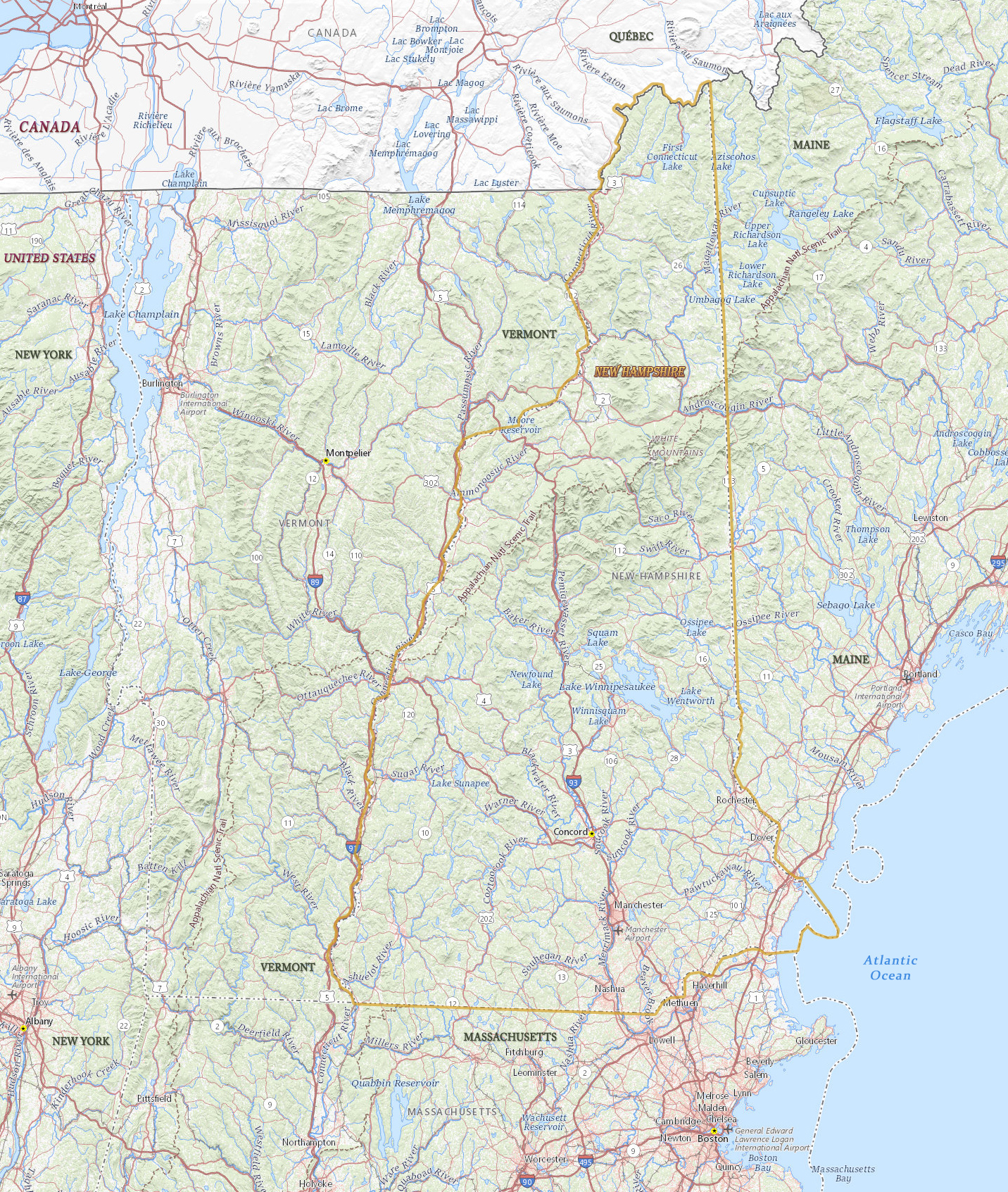
Map of New Hampshire
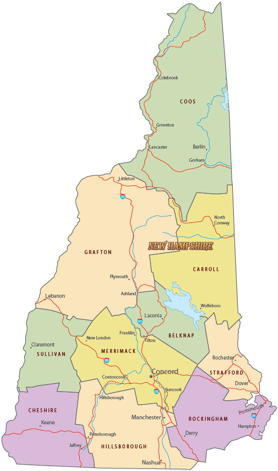
New Hampshire is one of the states in the northeastern region of U.S. It has more than a thousand lakes, the largest one is Lake Winnipesaukee. Most of the state is in the Appalachian Region. Concord is the state capital and Manchester is the largest city. New Hampshire is bordered by Canada and by the states of Maine, Massachusetts and Vermont.

Political Map of New Hampshire


|
Copyright © Geographic Guide - Travel United States of America. |
Source (edited): USGS National Map.
Map of New Hampshire