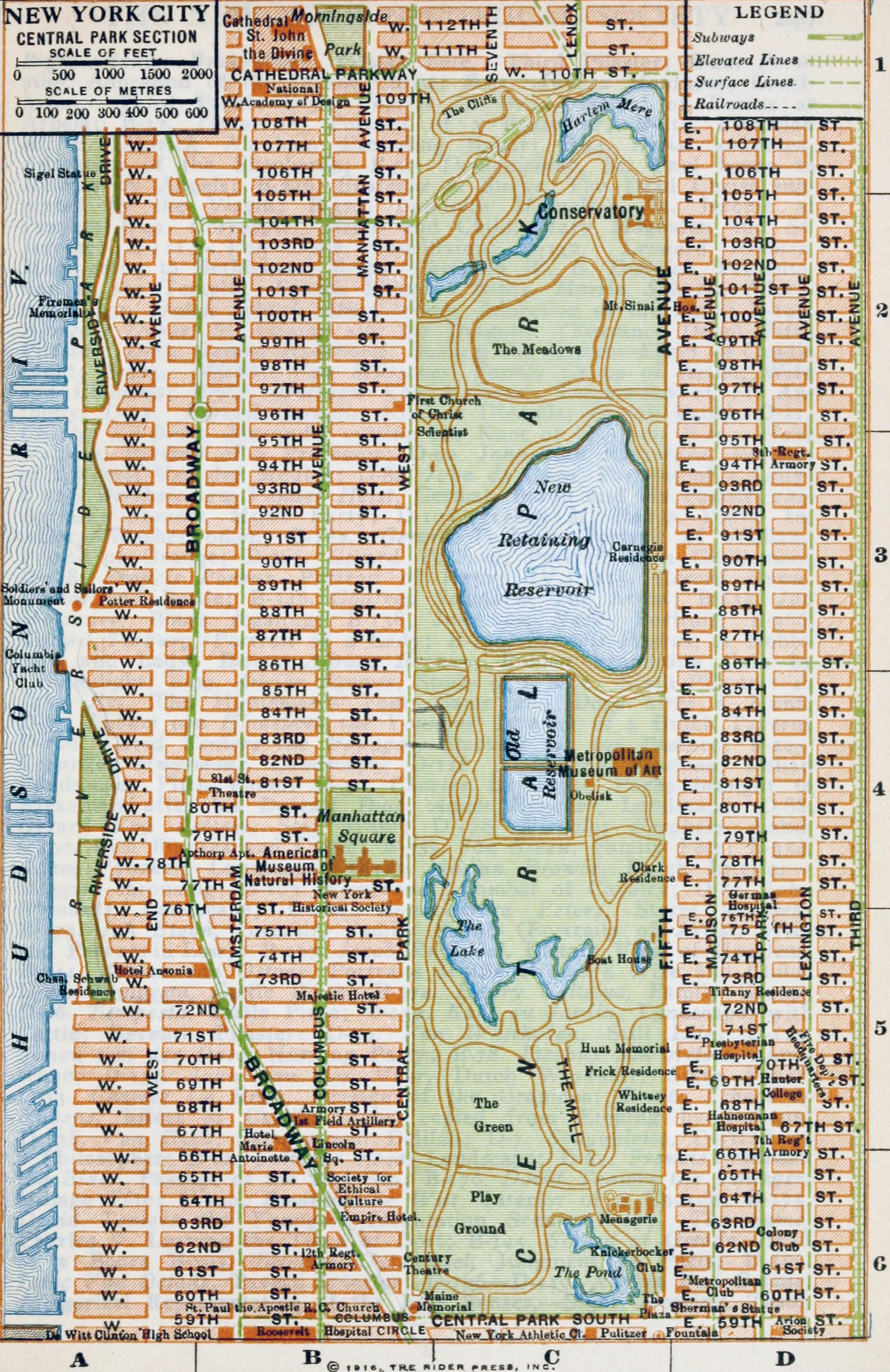
Map of Central Park - 1916
Map of Central Park, Manhattan from the Rider's New York city and vicinity, including Newark, Yonkers and Jersey City - a Guide-Book for Travelers, with 16 maps and 18 plans., compiled and edited by Fremont Rider. Published New York by Henry Holt and Company, 1916 by Rider Press.
Map shows features of Central Park and surrounding area from the Hudson River waterfront in the west to Third Avenue in the east, and from 59th Street in the south to 112th Street in the north. Below, text from the Guide:
From the Columbus Monument (PI. V — B6) at 59th street north to 63d street Roadway offers a continuation of "Automobile Row." At 63rd St. Broadway intersects Columbus ave., from Lincoln Square. Between the two avenues, facing N., stands the Hotel Empire (PI. V— B6). Between 65th and 66th streets W. side is Loew's Lincoln Square Theatre (PI. V— B6). Diagonally across, at N. E. corner of 66th Street and Columbus Ave., is Healy's Restaurant. E. on 66th St., No. 69, is the St. Nicholas Skating Rink, open until June ; admission, 50 c. Beyond is Durland's Riding Academy; and diagonally opposite is the Armory of the First Field Hospital, N. G. N. Y. On the W. side of Broadway, 66th to 67th Sts., is the Hotel Marie Antoinette (C. F. H. Gilbert, architect). Diagonally opposite, on the E. side, between 67th and 68th streets., is the armory of the First Battalion of Field Artillery. East on 68th St., No. 121, is the home of the Camera Club. Beyond it, at No. 115, is the College of Pharmacy of Columbia University, started in 1829 and affiliated with the University in 1904...

|
Copyright © Geographic Guide - 20th Century, Cartography, Old Maps NYC. |
Map of Central Park - 1916