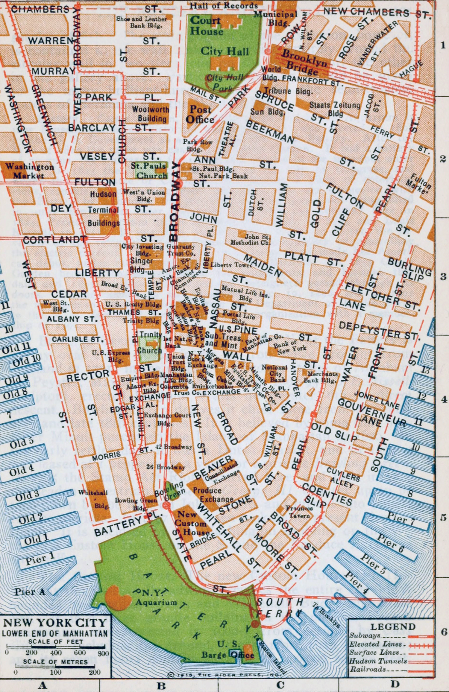
Map of Lower Manhattan - 1915
This is a map of Lower Manhattan from the Rider's New York city and vicinity, including Newark, Yonkers and Jersey City - a Guide-Book for Travelers, with 16 maps and 18 plans., compiled and edited by Fremont Rider. Published New York by Henry Holt and Company, 1916 by Rider Press. Map copyright 1915.
Map shows features from Battery Park to Chambers Street in the north. It includes streets, several piers on the Hudson and East rivers waterfronts, main transport lines and the names of important buildings of the time. Below, text from the Preface:
«The desirability of a
comprehensive guide book for what is unquestionably the greatest city in the
western hemisphere and in many respects the greatest city in the world is so
evident that no excuse for attempting its preparation seems necessary.
Neither does apology seem necessary for taking the admirable Baedeker series for
model. That portion of Baedeker's "United States" covering New York has been
perhaps our most thorough guide book treatment of the metropolis, and this
despite the fact that it sought to do in sixty pages what in the case of Paris
and London had taken four or five hundred pages. Where divergence has been made
from the well-known Baedeker style and format, it is hoped that the innovations
may be found to be improvements.»
More: Historical maps of New York City ►

|
Copyright © Geographic Guide - 20th Century, Cartography, Old Maps NYC. |
Map of Lower Manhattan - 1915