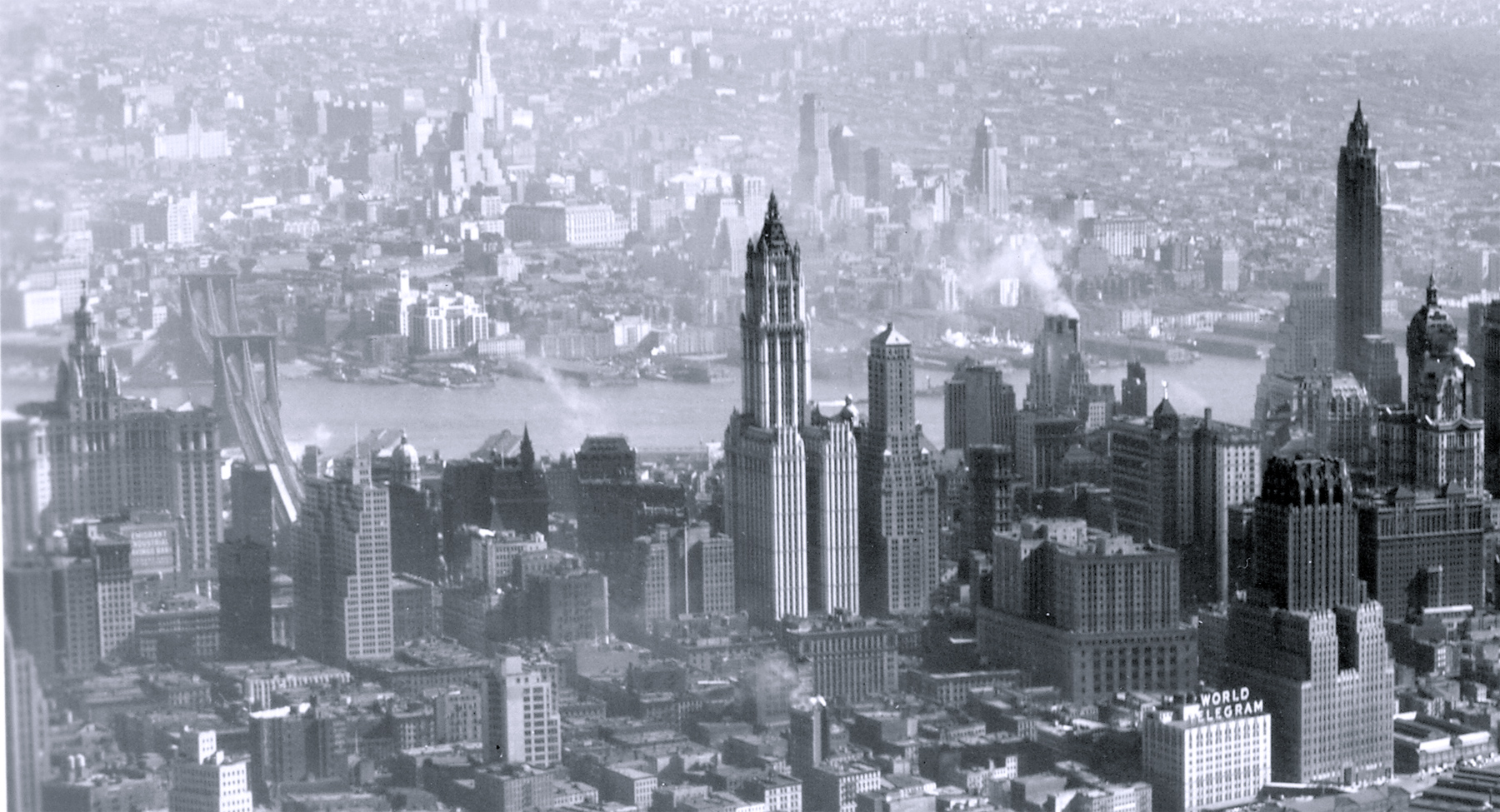
Lower Manhattan from Hudson River - 1940
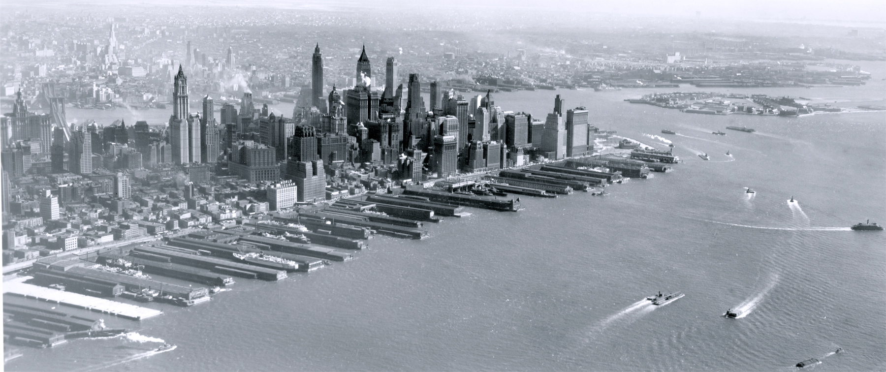
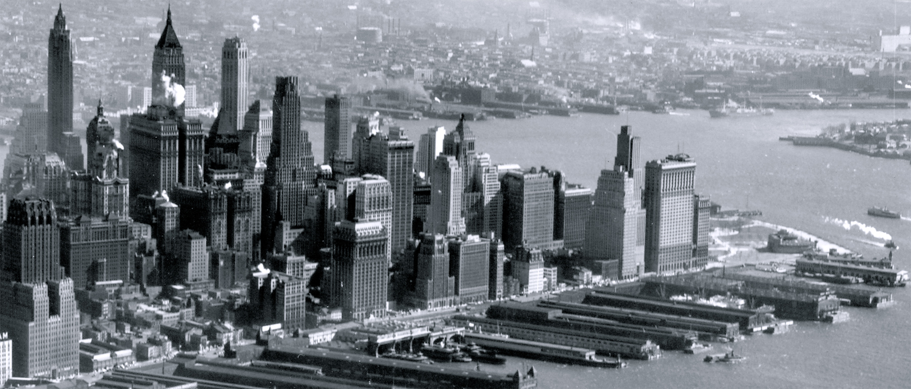
Aerial photo of Southern Manhattan from Hudson River, looking southeast. Photograph dated March 11, 1940. The Governors Island is on the right and Brooklyn is at the top of the photo. The Brooklyn Bridge over East River is on the left. The area on the left is what is now Tribeca neighborhood. Below, enlargements of the skyscrapers. Source: Mitchel Field, N.Y., Records of the Army Air Forces, U.S. National Archives and Records Administration.
The Hudson River is a 315-mile (507 km) river originated in the Adirondack Mountains of upstate New York. It flows from north to south primarily through eastern New York, United States. South of the Battery, the river proper ends, meeting the East River to form Upper New York Bay.
The West Street was then the westernmost street in Manhattan at the time. Later, a landfill replaced the old docks on the Hudson River waterfront, the Battery Park City, with new streets, parks and cultural venues.
City Hall Park
Lower Manhattan from Hudson River - 1940
|
Copyright © Geographic Guide - 20th Century NYC Skyscrapers. |