Mali Map - Africa
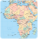
◄ Africa
The African country of Mali in divided into ten regions and the District de Bamako, the capital. Ten regions are: Gao, Kayes, Kidal, Koulikoro, Menaka, Mopti, Segou, Sikasso, Taoudenni and Tombouctou. Most of the Mali area is in the Sahara Desert. The country has border with Niger, Burkina Faso, Mauritania, Côte d'Ivoire, Guinea, Senegal and Algeria.
|
Copyright © Geographic Guide - Travel, African Continent. |