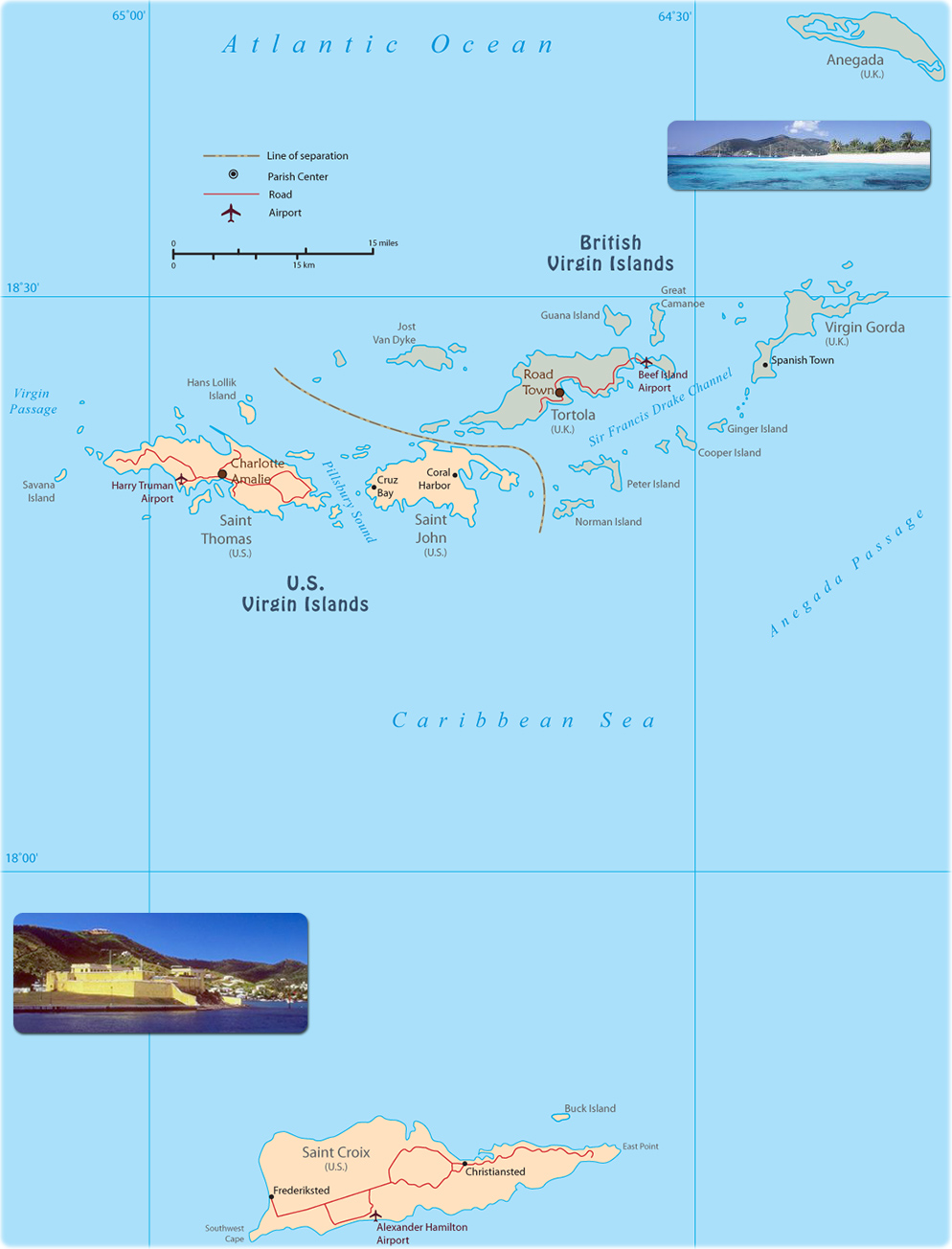
Map of the Virgin Islands
British Virgin Islands are an overseas territory of the UK. It includes the islands of Tortola, Anegada and Virgin Gorda. United States Virgin Islands are a territory of the US. It includes the islands of Saint Croix, Saint John, Saint Thomas.
Sandy Cay
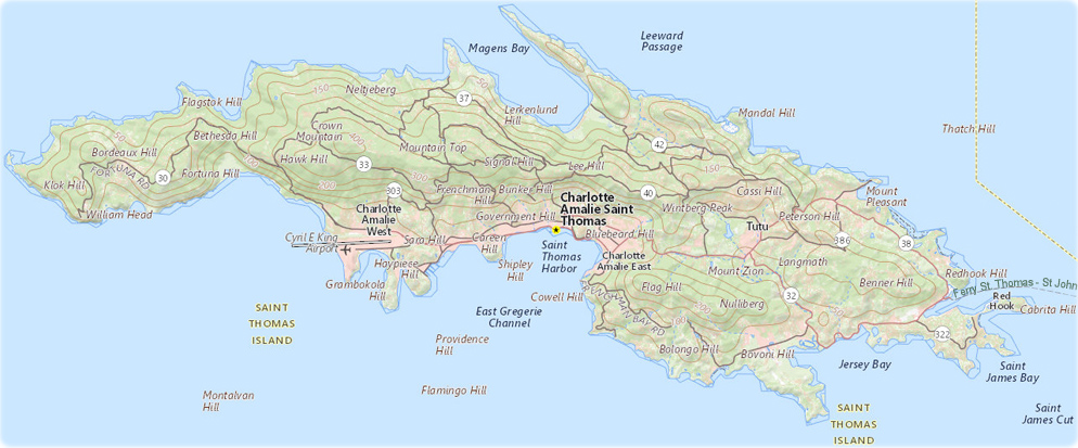
Map of Saint Thomas Island - U.S. Virgin Islands

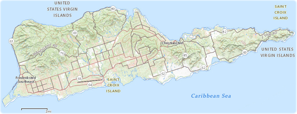
Map of Saint Croix Island
Caribbean Sea
|
Copyright © Geographic Guide - Travel Caribbean Islands. |
Source (edited): USGS National Map.
Old fort, St. Croix.

Source (edited): USGS National Map.