
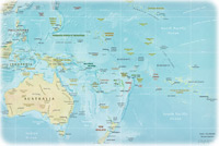
Map of the U. S. Territory of Samoa

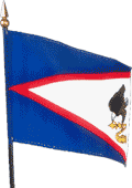
The Territory of the Samoa of the United States is administered by the US Department of the Interior. It is located about half way between Hawaii and New Zealand and includes Rose Island and Swains Island. The highest point is Lata Mountain 964 m. The capital is Pago Pago. There is also the independent country named Samoa.
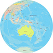
More in Oceania: Fiji, Australia, Guam, Nauru, Kiribati and Tuvalu.
◄ Oceania


|
|
Copyright © Geographic Guide - Travel Pacific Islands. |
Map of the U. S. Territory of Samoa