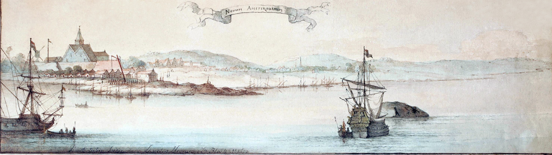
Novum Amsterodamum / New Amsterdam - 1650
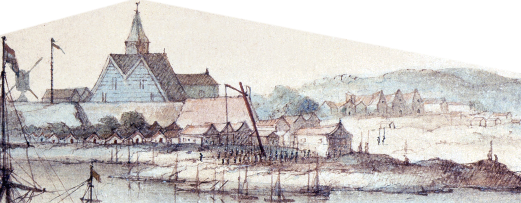
This is a reproduction of an original wash drawing in sepia and color on paper by artist Laurens Block, dated 1650, in possession of the New-York Historical Society. Original title: Novum Amsterodamum (New Amsterdam). Enlargement of main buildings and comments by I.N. Phelps Stokes are below.
I.N. Phelps Stokes' comments on this drawing (Iconography of Manhattan Island, ...1915) are below:
«The drawing, (...), is still in its original carved wood frame, (...). Although this frame is undoubtedly old, it dates probably from the eighteenth and not from the seventeenth century. The date of the view is fixed by the inscription in the lower left margin, which has always been interpreted to read: In’t Schip Lydia door Lavrens Hermans Zn. Block A°. 1650. (In the ship Lydia by Laurens Block, son of Herman, in the year 1650.) ...
At first sight the view appears to depict a period considerably earlier than that of the Visscher View [date depicted: 1651-1655], but a careful examination shows that this impression is due chiefly to the fact that the portion of the town east of the Fort is very sketchily drawn. However, certain omissions, such, for instance, as that of the “gallows,” which in the Visscher View appears near the crane, seem to indicate a somewhat earlier date. The little wooden wharf or pier, built by Stuyvesant, probably in 1648-9 (...), cannot be positively identified, but, no doubt, exists just south of the crane, where its presence seems to be indicated by a group of small boats. The three gabled buildings which are seen a short distance east of the Fort are the Company’s Pack Huys and the two store-houses belonging, respectively, to Paulus Leendertsen vander Grift and Augustine Herrman, which stood on the Strand (Pearl Street), about 100 feet east of the Marckveldt (Whitehall Street). The Pack Huys was not finished before 1649, and the warehouse of vander Grift was probably not begun until after July 25, 1650, on which date he received permission to use the party wall of the Pack Huys. That of Herrman must have been built between 1645, when he received his ground-brief, and 1651, when he deeded his property to the Estate of Daniel Gabry, the deed mentioning the house. ...
The topographical features of the view are not very accurately depicted. For instance, there is far too much foreground between the water-front and the first row of houses along the Strand, and the Stadt Huys, which appears above the rock at the right of the view, is too far removed from the rest of the settlement.
The genuineness of this view has been disputed, and no record has been found of Laurens Block, or of the ship ‘‘Lydia.’’ However, the general appearance of the drawing and of the frame is suggestive of authenticity. If a forgery, the view is undoubtedly copied from the Montanus View (...). If genuine, it may possibly be the original sketch by Augustine Herrman, referred to by Stuyvesant in 1660 (...), although this was probably not made until some years later.» More: Maps of NYC - 17th Century ►

Enlargement of the main buildings.
|
Copyright © Geographic Guide - 17th Century NYC. Old Maps |

Similar drawing probably by the same artist.
Novum Amsterodamum / New Amsterdam - 1650