 In the early 16th century, Manhattan was inhabited by the Lenape people. They occupied the lower Hudson River Valley and the Delaware
Valley. The Lenape were skilled hunters. Many species of game and cultivated
fields of vegetation served as food for them who lived in circular
huts with grass-thatched roofs. About 5,000 Lenapes lived in about 80 settlements
around the region.
In the early 16th century, Manhattan was inhabited by the Lenape people. They occupied the lower Hudson River Valley and the Delaware
Valley. The Lenape were skilled hunters. Many species of game and cultivated
fields of vegetation served as food for them who lived in circular
huts with grass-thatched roofs. About 5,000 Lenapes lived in about 80 settlements
around the region.
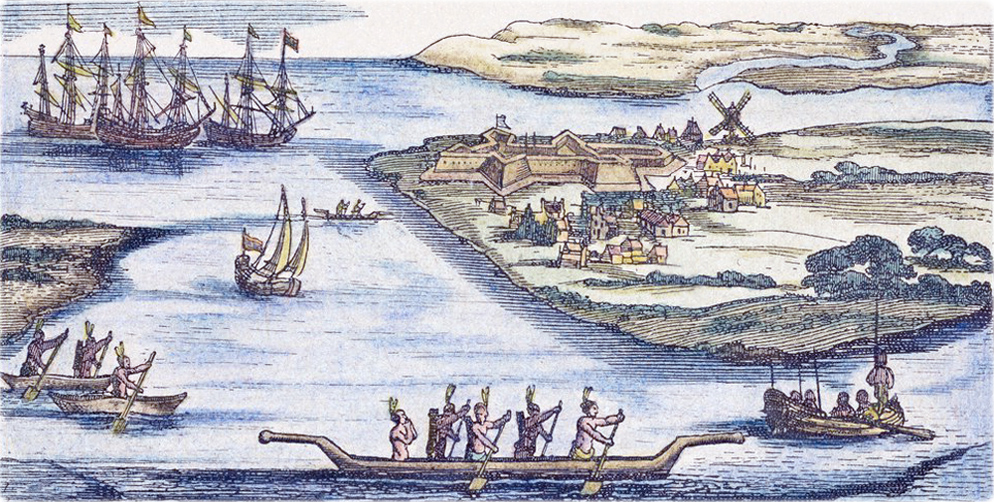
The first contact of the Lenape people with Europeans was in 1524, when Florentine explorer Giovanni da Verrazzano (1485-1528), in the service of the King Francis I of France, explored North America. The canoeing Lenape encountered Verrazzano’s ship, La Dauphine, in Lower New York Bay. While investigating the Bay, Verrazzano documented what he believed to be a lake, which was actually the entrance to the Hudson River.
In 1609, English explorer Henry Hudson was sailing on behalf of the Dutch East India Company, looking for easterly passage to India, on his ship Halve Maen (Half Moon), and spent ten days ascending the River that now bears his name. Hudson failed of his main objective, but the Dutch merchants recognized the importance of fur trade and strategic importance of the river. His voyage was used to establish Dutch claims to the region.
In 1613, Dutch explorer and private trader Adrian Block (1567-1627), built huts on Manhattan Island on the site of today's 45 Broadway Atrium, after the burning of his vessel, the "Tiger", and he lived there while building his new ship, the Onrust. In September 1890 a bronze tablet was installed by the Holland Society of New York, on the façade of 41-45 Broadway (then Aldrich Court Building), with an inscription commemorating the event.
In 1614, Hendrick Christiaensen, a Dutch explorer, sailed up the North River to Castle Island (now in Albany County N.Y.) and built a warehouse on the ruins of an abandoned French fur trader's fort. He named it Fort Nassau, which was the first Dutch settlement in North America. By 1618 it was abandoned due to frequent flooding.
In 1624, a ship with 30 Walloons landed in New Netherland and 18 of the men were sent, under direction of the Dutch, to built Fort Orange, near present day Albany, about 2 miles north of Fort Nassau. The new fort was also prone to flooding.
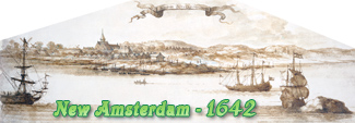
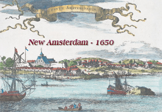
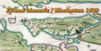
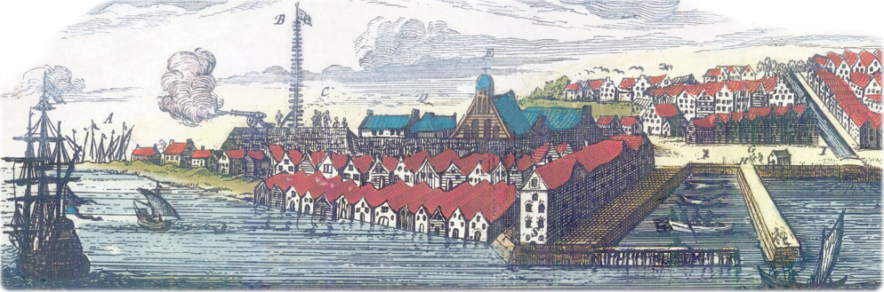
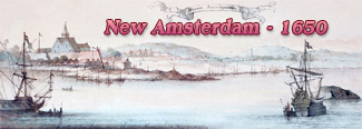
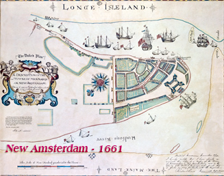
In the same year of 1624 the Dutch West India Company sent some 30 families to live and work in New Amsterdam (Dutch: Nieuw Amsterdam), which was part of the Dutch colonial province of New Netherland. They first set up camp in "Noten Eylandt" (today’s Governors Island). A fort and a sawmill were constructed on the island.
 In
1626, Peter Minuit, Director-General of New Netherland, bought
Manhattan Island from the natives, so the settlement, fewer than 300 people,
moved to Manhattan. It was then a land covered with green forests, berry patches
and babbling brooks.
In
1626, Peter Minuit, Director-General of New Netherland, bought
Manhattan Island from the natives, so the settlement, fewer than 300 people,
moved to Manhattan. It was then a land covered with green forests, berry patches
and babbling brooks.
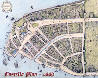
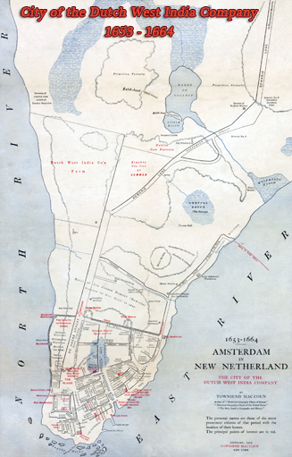
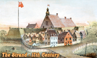
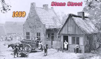
Most streets in lower Manhattan was developed organically as the colony of New Amsterdam grew. The roads were a mixture of country lanes, short streets and Native American and animal trails. During the Dutch rule, New Amsterdam was governed by the Directors-General of New Netherland. On February 2, 1653, New Amsterdam was chartered as a city, under Dutch control. In the same year, the City Wall was erected on the northern part of what is now Wall Street.
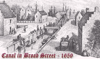
 In the 17th century,
Dutch and later English taverns were the usual place used as accommodation
for travelers in Manhattan. Taverns were also places to drink, to eat, to meet
and to discuss political or social issues. Sometimes, taverns were also used as
courtrooms, trading posts, post offices, and convenience stores.
In the 17th century,
Dutch and later English taverns were the usual place used as accommodation
for travelers in Manhattan. Taverns were also places to drink, to eat, to meet
and to discuss political or social issues. Sometimes, taverns were also used as
courtrooms, trading posts, post offices, and convenience stores.
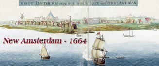
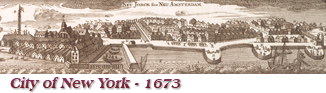
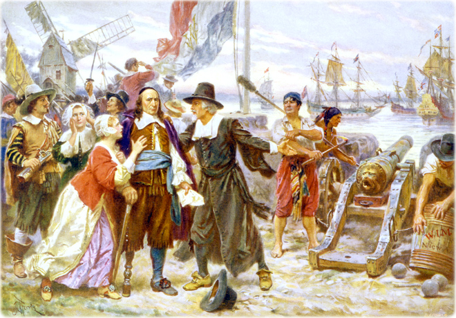
In September of 1664, English forces took control of New Amsterdam, which was ill-equipped to defend itself. The Dutch surrendered without a fight. In the same year, Charles II gave this land to his brother Duke of York (later James II). The colony and city were renamed New York in his honor.
The City of New York was run by the British military governor, Richard Nicolls. The office of Mayor of the City of New York was established in 1665. Before 1680, mayors served one-year terms. From 1680, they served two-year terms. In 1665, Thomas Willett (c.1607 - 1674) became the first Mayor of the City of New York. In 1666, Thomas Delavall (1620-1682) was appointed to the post, replaced by Willett, again, in 1667 and then by Cornelius Van Steenwyk, in 1668.
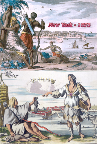
On August, 1673, began a brief Dutch reoccupation of New York, which was renamed New Orange, but, in 1674, the Treaty of Westminster was signed, giving the official ownership of Manhattan to the English. Although the Treaty was ratified by the Dutch on March 5, the Dutch occupation lasted until October 31, 1674.
In December, 1683, six wards were established for the City of New York by the Dongan Charter (officially approved by the province on April 27, 1686). Five of the these wards (West, North, East, South and Dock) were located in what is now the Financial District of Lower Manhattan, while the Out Ward covered the rest of Manhattan. The Dongan Charter established the City of New York as self-governing corporation. By this Charter, some public, unpatented lands became property of the City, including the Common, now City Hall Park.
In 1693, the construction of the King's Bridge to the Bronx connected Manhattan to the mainland and it became part of the Boston Post Road. By the late 17th century, Manhattan was rapidly growing into a leading colonial port. In the last two decades, buildings and residents increased by about two-thirds. In 1700 the city had nearly 5,000 residents.
More: Maps of NYC in the 17th Century ►