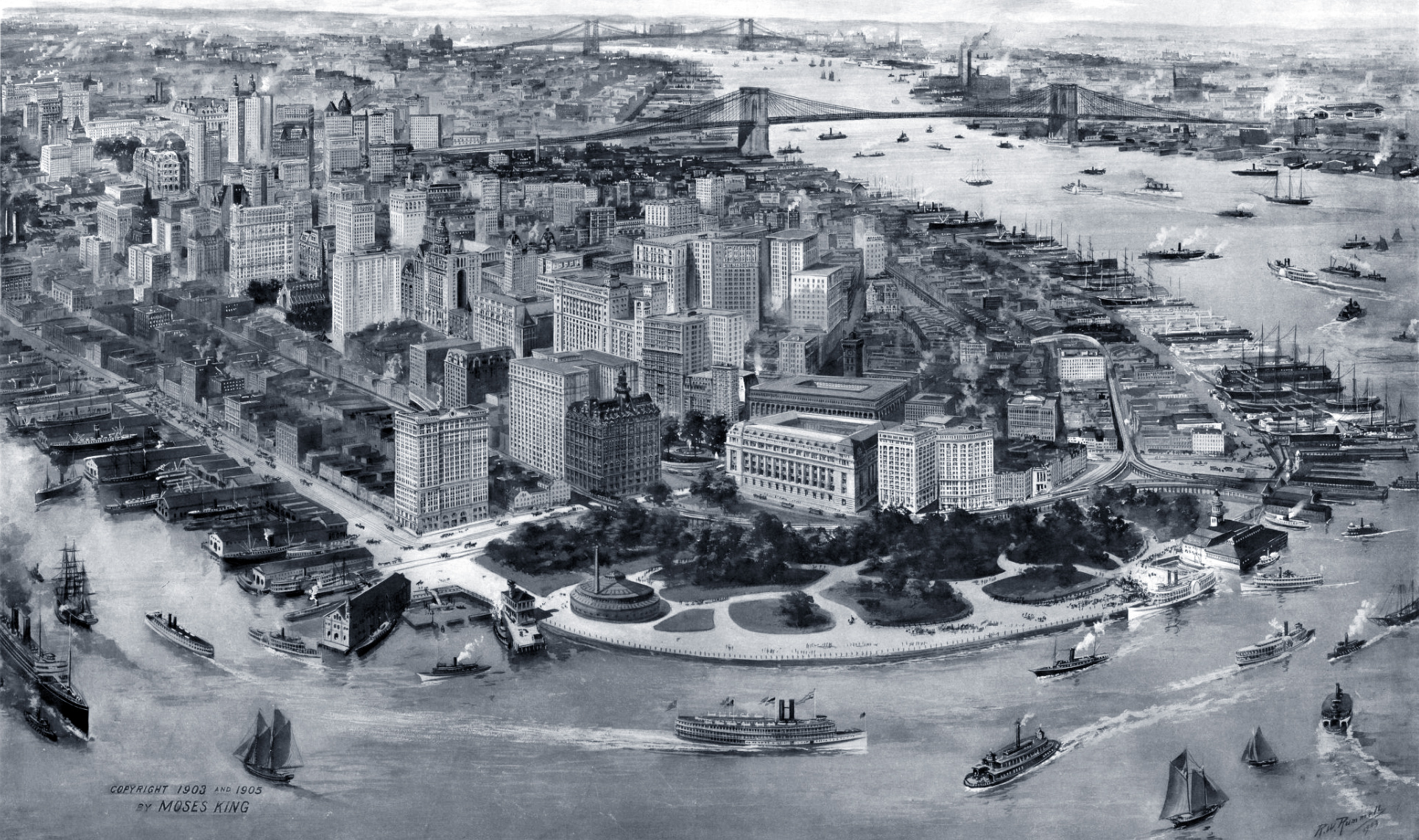
New York City, Aerial Image - 1905
Aerial image of the business center of the borough of Manhattan, New York City in 1905. Creator: Richard Rummell (1848-1924). Engraved and printed by A.W. Elson and Co. Published by Moses King, NY. Source: Norman B. Leventhal Map & Education Center, Boston Public Library.
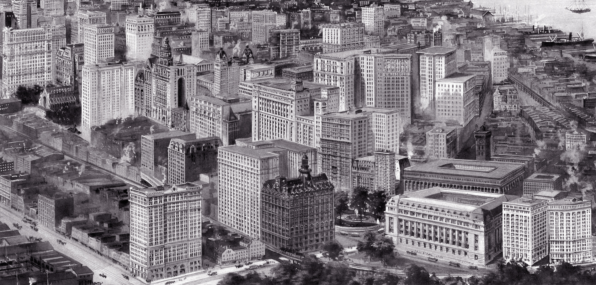
Although this image is signed on the lower right corner for the year 1903, it actually depicts the year 1905. It shows the 21-story Trinity Building, 111 Broadway, erected on the site of the old 5-story building of the same name, constructed in 1853. The new Trinity Building was constructed from 1904 to 1905, and enlarged in 1907. Below, enlargement of the center.
Pier A was built as the headquarters for the New York City Docks Department in 1886 and subsequently used by a variety of municipal agencies over the years, including the city’s police and fire departments.
A previous image was released for 1903.
More: Maps of NYC - 20th Century ►

Bowling Green
More: Historical maps of New York City ►
Pier A
The Battery


New York City, Aerial Image - 1905
|
Copyright © Geographic Guide - 20th Century NYC. |