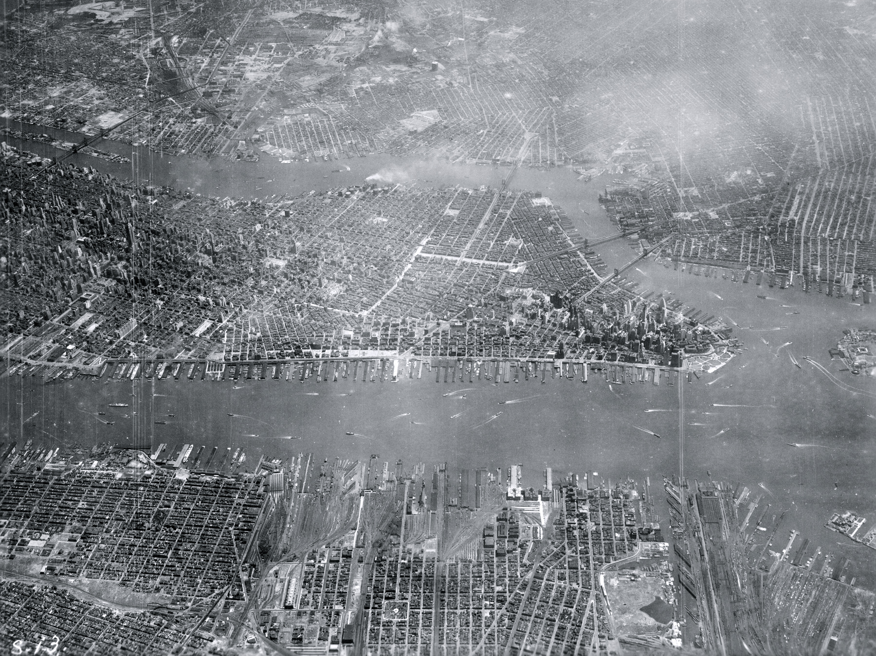
Aerial Photograph of Lower Manhattan - 1931
Aerial photograph of Midtown and Lower Manhattan, with New Jersey in the foreground. Photo taken by Capt. A.W. Stevens from approximately 23,000 ft altitude, dated May 1931. Source: Airscapes - New York City. Wright Field, Ohio. Records of the Army Air Forces, U.S. National Archives and Records Administration. Enlargement of Lower Manhattan is on the right.
NYC was then and still is the most populous city in the United States of America, located at the southern tip of New York State on one of the world's largest natural harbors. New York City traces its origins to a trading post founded on the southern tip of Manhattan Island by Dutch colonists about 1624.
East River
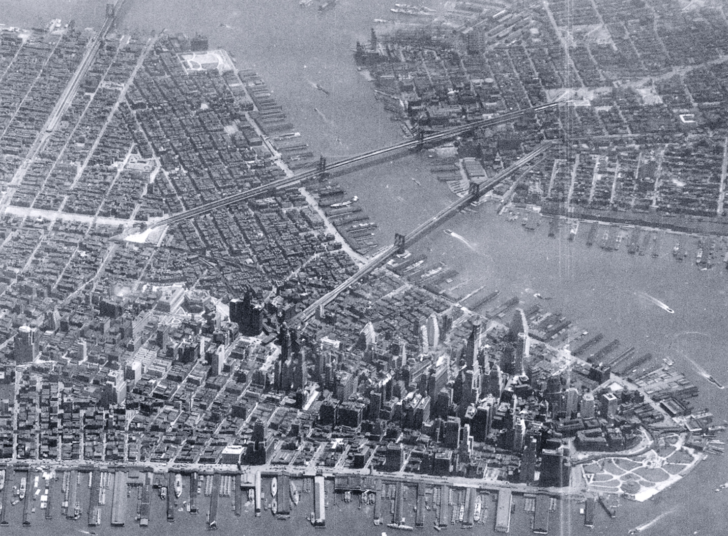
Brooklyn
|
Copyright © Geographic Guide - Old Pictures, 20th Century New York City. |

Aerial Photograph of Lower Manhattan - 1931
Hudson River