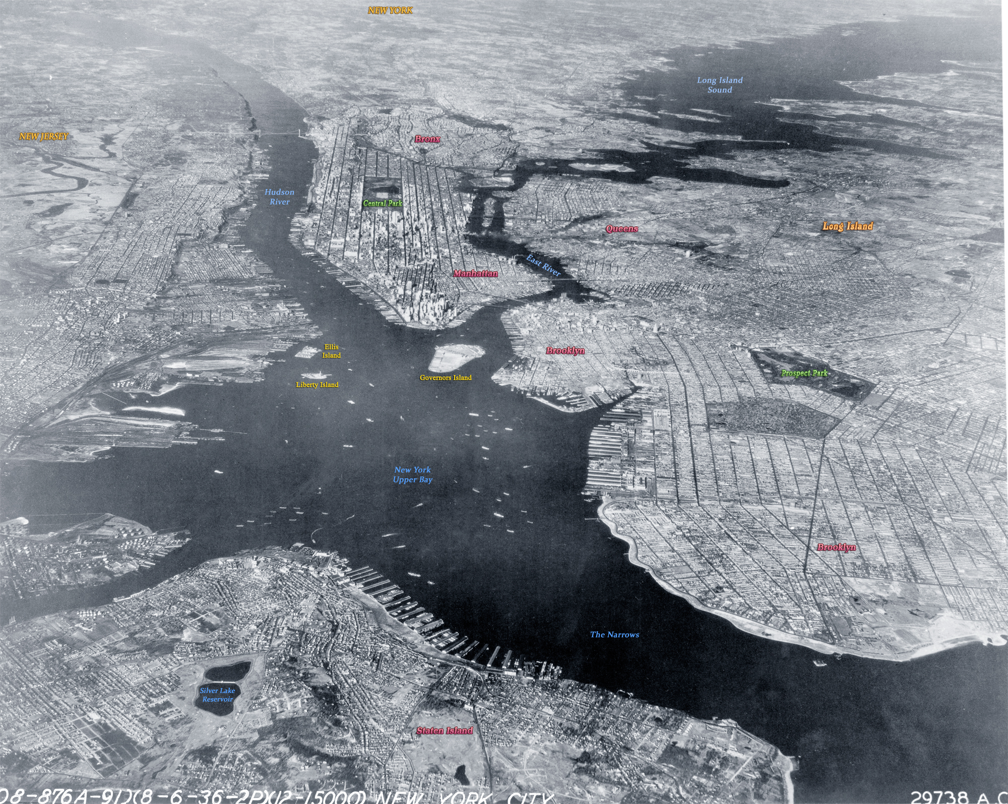
City of New York and Harbor - 1936
Aerial photo of the New York City and Bay, looking north. New Jersey is to the left and Long Island is to the right. Photograph dated August 6, 1936. Source: Bolling Field, Records of the Army Air Forces, U.S. National Archives and Records Administration.
New York Bay is usually divided into Upper New York Bay (in this photo) and Lower New York Bay, connected by the Narrows (on the right). The term New York Harbor usually refers to Upper New York Bay and the surrounding Port of New York and New Jersey, but sometimes is taken as a synonym for New York Bay.
The view also includes the Hudson River, East River (a saltwater estuary), the boroughs of the City of New York (Manhattan, Brooklyn with Prospect Park, the Bronx, Queens and Staten Island), Long Island Sound, Governors Island, Liberty Island and Ellis Island.

|
Copyright © Geographic Guide - 20th Century NYC Old Harbour. |
City of New York and Harbor - 1936