
Map of The Battery - 1852
Map of the Battery and Bowling Green parks, on the southern tip of Manhattan in 1852. Source: NYPL.

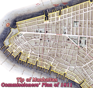
Above, fragment of the Bird's-eye View of New York City and Brooklyn by John Bachmann, copyright 1850, showing the southern tip of Manhattan, where the Hudson River and the East River meet the bay, with Battery Park (created in 1823) and Bowling Green (created in 1733). Source: Collection of Graphic Arts and Social History, Huntington Digital Library..
In 1855, the Castle in the Park, a former naval fortification, became the Castle Garden Immigration Station.

|
Copyright © Geographic Guide - Maps of NYC. Historic Places. |

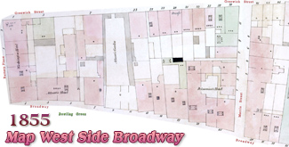

Map of The Battery - 1852