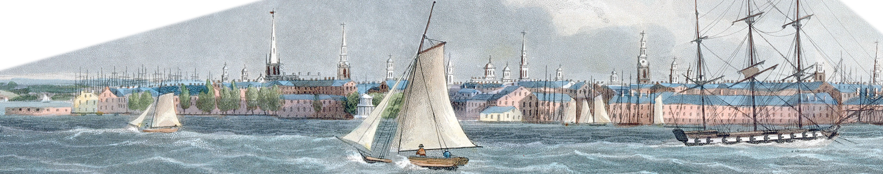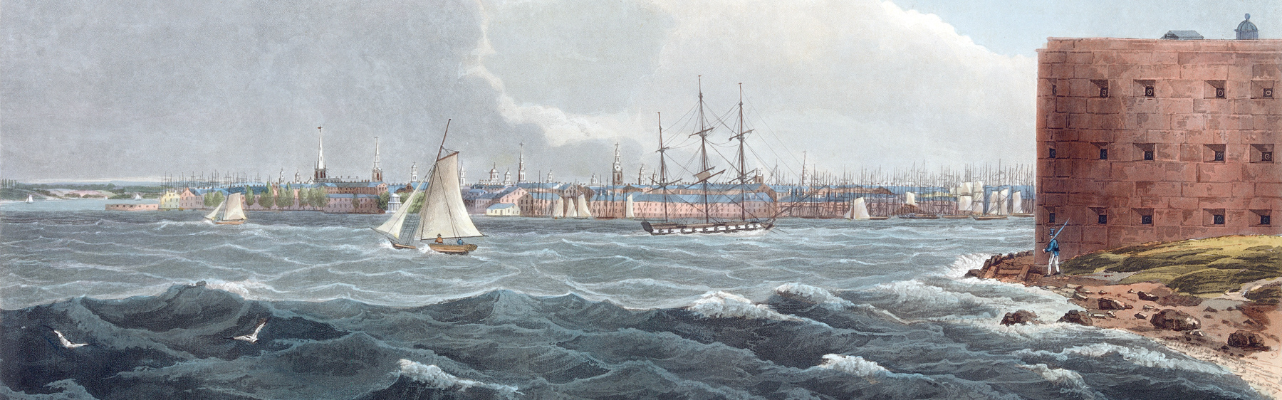
New York from Governors Island - 1823
The southern tip of Manhattan from Governors Island, in Upper New York Bay. Castle Williams, a fortification completed in 1811, is on the right. Illustration engraved by John Hill after drawing by William Guy Wall (1792-1864). Published by Henry J. Megarey, New York, 1823-1824. The print is part of the Hudson River Portfolio (No. 20), an American printmaking produced through the collaboration of artists, a writer, and publishers. In the summer of 1820, the Irish-born William Guy Wall toured and sketched along the Hudson River, then painted a series of watercolors. Below, enlargement of the skyline of New York.
The depicted skyline of the city is of great historical value. In 1823, the first franchise for supplying the City of New York with gas was granted by the Common Council to the New York Gas Light Company. The opening of the Erie Canal, in 1825, boosted even more the development of the City of New York and the shipping traffic around Manhattan became heavy.
|
Copyright © Geographic Guide - NYC and Brooklyn in the Nineteenth Century. |
Enlargement of the southern tip of Manhattan


Hudson River
New York from Governors Island - 1823