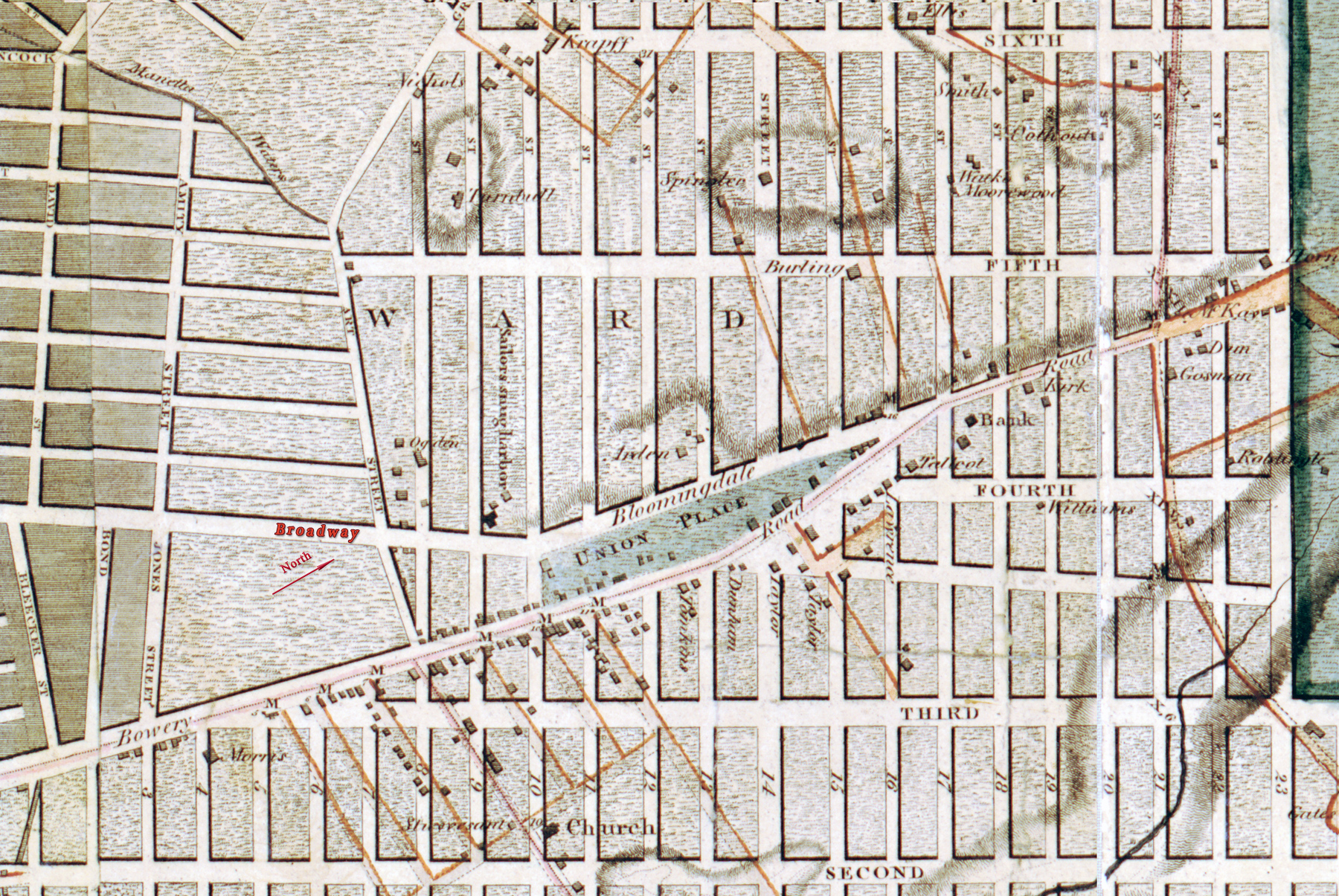
Map of Union Place - Commissioners’ Plan of 1811
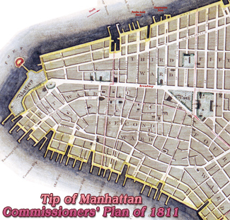
This is a fragment of the map of the City of New York and Island of Manhattan, as laid out by the commissioners appointed by the New York State Legislature, on April 3rd, 1807. The map was released in 1811. This fragment shows the area around Union Place, junction of Bowery Road and Bloomingdale Road (continuation of Broadway), as originally planned by the commissioners. Additional text in red. Source: Library of Congress Geography and Map Division.
John Randel, Jr. (1787-1865) was the chief surveyor for the commission responsible for laying out streets and roads in the City of New York, as appointed by the act of April 3, 1807. Randel is credited with creating the resulting map.


Map of Union Place - Commissioners’ Plan of 1811
|
Copyright © Geographic Guide - 19th Century in Manhattan - NY. |