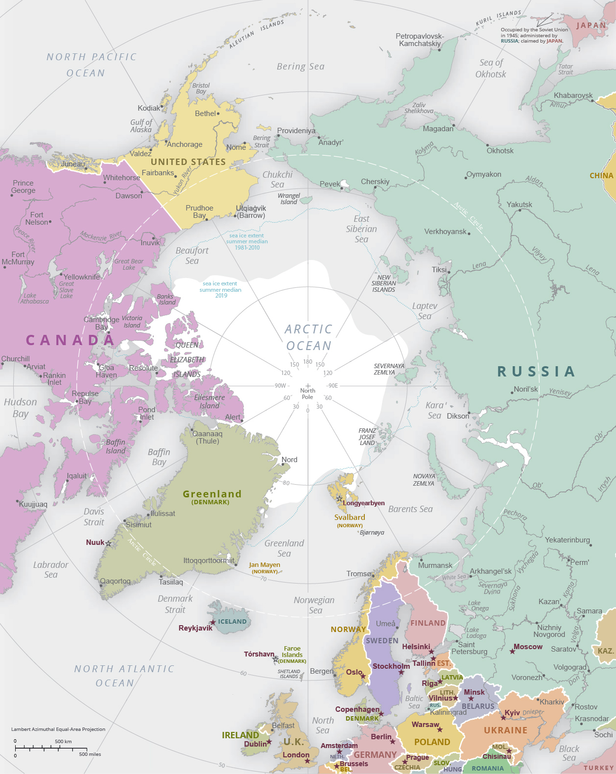
Political Map of the Arctic Region
The political division around the Arctic Region consists land areas of the surrounding eight Arctic countries: United States (Alaska), Canada, Finland, Greenland (Denmark), Iceland, Norway, Russia, and Sweden.
The high Arctic has an extreme environment and many areas lack infrastructure. The overall level of economic activity is still relatively low although it has been increasing in recent decades in certain areas.
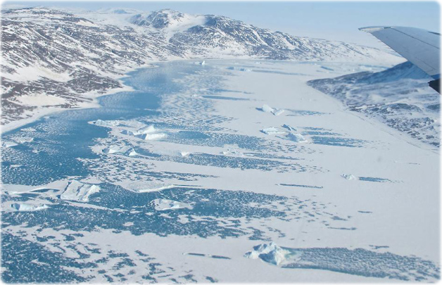
Frozen fjord along northeast coast of Greenland. Credit NASA - Jim Yungel.
Political Map of the Arctic Region
|
Copyright © Geographic Guide - Continents of Planet Earth. |