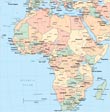
Map of Chad


|
Copyright © Geographic Guide - Travel, African Continent. |
Lake Chad, Africa (NASA - October 1968). The north and south basins of Lake Chad are visible in this southeast-looking photograph. The boundaries and depth of the lake fluctuate from season to season and year to year. Lake Chad is the 4th largest lake in Africa and the 17th largest lake in the world, covering an area of nearly 16,000 km². The average depth of the lake in the north is only 3 m, whereas the average depth in the south is nearly 6 m. The lake is fed by two major rivers, the Chari and the Komadugu Gana, and by many lesser streams; but, it has no outlet. Lake Chad is a freshwater lake, which is very unusual for a desert lake. Located on the southern boundary of the Sahara Desert, Lake Chad contains numerous sand dunes or islets in both its northern and its southern basin. Two million years ago, when the climate was much wetter, Lake Chad covered a large portion of the south-central Sahara Desert. As the climate became drier and some geologic uplifting occurred to the south of the lake, sending rivers that had been draining into the lake southward into the Congo Basin, the lake shrank to little more than 10% of its original size. Lake Chad continues to shrink because of droughts that plague that region of Africa. The northern basin, which is almost completely cut off from the southern basin by a ridge known as the Great Barrier, is especially vulnerable to any short-term changes resulting from drought conditions and excessive evaporation.
The Republic of Chad (Jumhuriyat Tshad) is a country in the Sahara region, with 23 regions: Barh el Gazel, Batha, Borkou, Chari-Baguirmi, Ennedi-Est, Ennedi-Quest, Guera, Hadjer-Lamis, Kanem, Lac, Logone Occidental, Logone Oriental, Mandoul, Mayo-Kebbi Est, Mayo-Kebbi Ouest, Moyen-Chari, Ouaddai, Salamat, Sila, Tandjile, Tibesti, Ville de N'Djamena, Wadi Fira. It has borders with Cameroon 1,116 km, Central African Republic 1,556 km, Libya 1,050 km, Niger 1,196 km and Nigeria 85 km,.
◄ Africa