
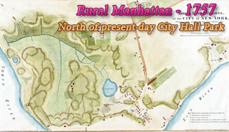
City of New York, Survey by James Lyne
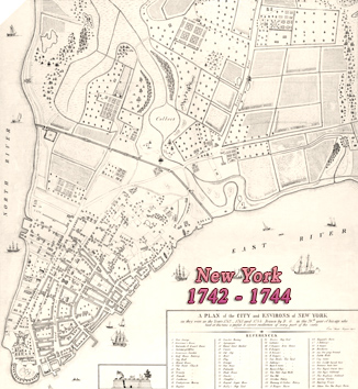
Original title: "A Plan of the City of New York from an actual survey made by James Lyne", dated 1728 on the top right corner. This version was printed by George Hayward, lithographer (1834–1872), in 1834 and for D.T. Valentine's History of New York 1853, from a facsimile of an original map in possession of G.B. Smith, street commissioner. Source: Metropolitan Museum of Art, New York. Another version James Lyne's Plan, dated 1729, was published in the Valentine's Manual for 1850.
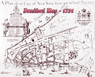
Coat-of-arms of Col. Robert Lurting, mayor of New York City from 1726 to 1735. Dedicated by William Bradford to John Montgomerie, Captain General & Governor in Chief of the Provinces of New York and New Jersey, from 1728 to 1731.
This is a version of the original map, more commonly known as the "Bradford Map", 1731. The original map was printed and published by William Bradford (1663-1752), publisher of the New-York Gazette, the first New York newspaper, beginning in 1725. The Bradford Map was the first map of the City printed in New York.
Below, a color version by Henry Dunreath Tyler about the late 19th century. Source: Norman B. Leventhal Map Center, Boston Public Library.
Although the year "1728" is printed in the upper right corner, this map is believed to have been made in 1730. See more about the Bradford Map ►
|
Copyright © Geographic Guide - 18th Century Maps, City of New York. |


City of New York, Survey by James Lyne