
Map of New York - 1729

Although the year "1729" is printed on top, this map is believed to have been made in 1730.
More about the Bradford Map ►
More: Historical maps of New York City ►
|
Copyright © Geographic Guide - 18th Century NYC. Historical Maps of United States of America. |
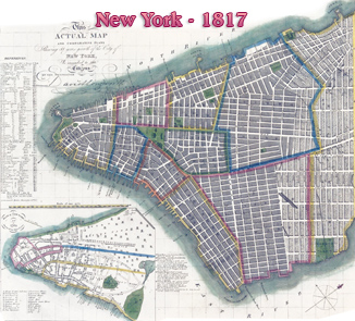
The source map published by David Longworth in 1817.

Original title: "Plan of New York in 1729, surveyed by James Lyne", oriented with north to upper right. It is an inset of another map issued in 1817, published by David Longworth, as comparative maps showing the growth of 88 years of the City of New York. Source (edited): Lionel Pincus and Princess Firyal Map Division / New York Public Library.
Another version of this map is shown below, a redrawing for the Valentine's Manual for 1850, lithograph by H.R. Robinson. See other versions of the James Lyne's Survey.
After the Montgomery Charter, the James Lyne map showed the new ward boundaries and the addition of a new ward, the Montgomerie ward northeast of the city. More: Maps of NYC - 18th Century ►
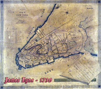
The Manuscript Plan, Survey by James Lyne.
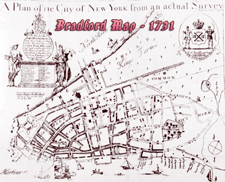

Map of New York - 1729