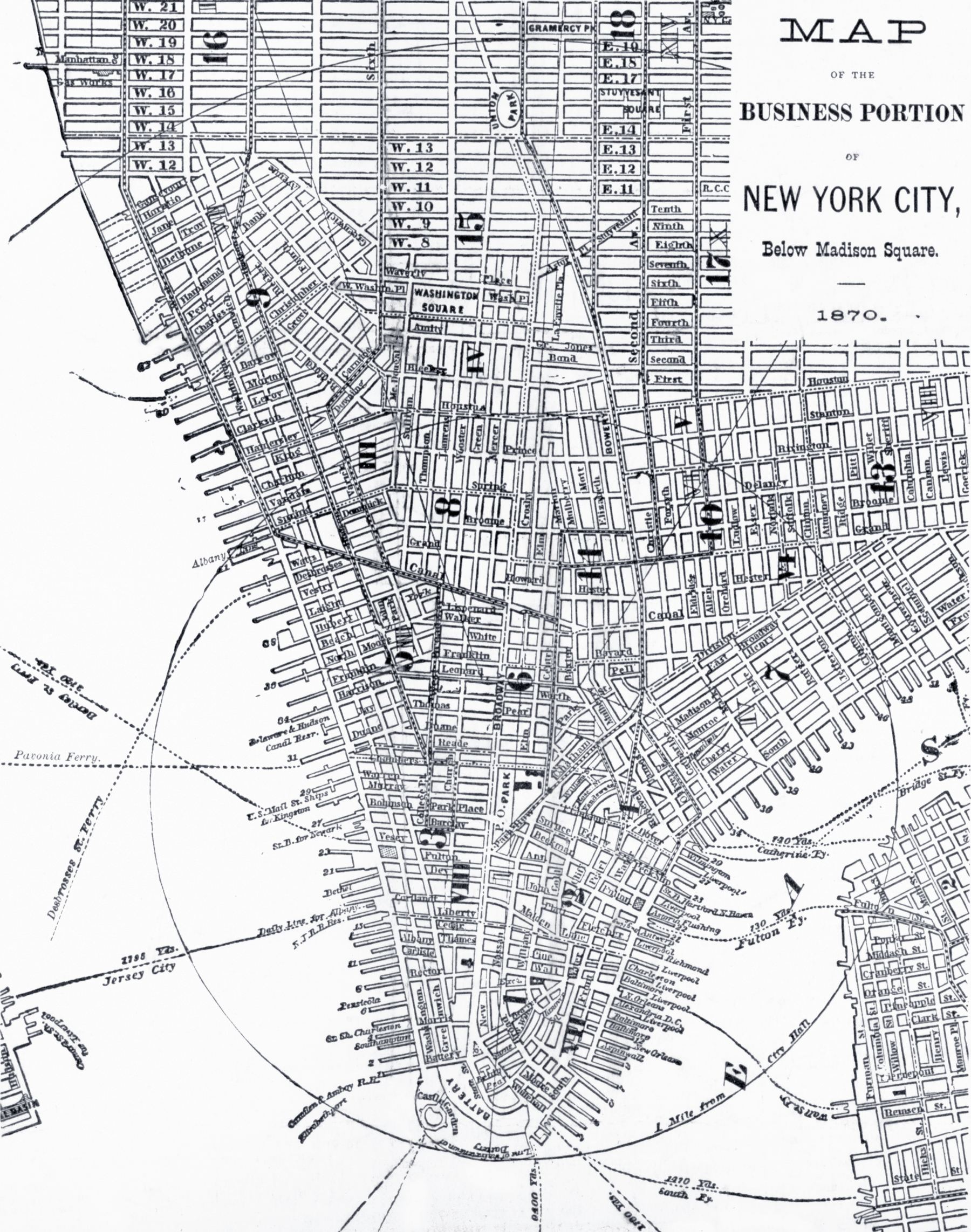
Map of the Business Portion of New York City, below Madison Square - 1870
Map of the business area of New York City, below Madison Square, showing the location of the different steamship, steamboat, railroad piers and ports in 1870.
Entered according to act of Congress, in the year 1870, by Joseph Mackey (1832-1896), in the Clerk's Office of the District Court of the Southern District of New York. Issued as the summer 1870 no. of Mackey's Shipping Indicator (broadsheet). Source: Library of Congress Prints and Photographs Division.
More: Historical maps of New York City ►


|
Copyright © Geographic Guide - 19th Century NYC. Historical Maps. |