
Maps of New York City - 19th Century
By the turn of the century, New York became the largest city in the United States, with a population of over 60 thousand people.
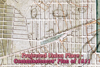
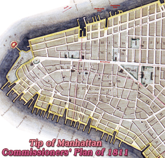
The street grid of Manhattan was introduced by the Commissioners’ Plan in 1811, seeking to provide for orderly development and land sales in Manhattan. It was a design for the streets of Manhattan above Houston Street and below 155th Street. The Commission was appointed by New York State Legislature, in 1807, in support of the Common Council of the City of New York.
In 1870, New York City had almost one million residents and the early skyscrapers were being constructed. Since then, Lower Manhattan's skyline has changed dramatically decade after decade. Utility poles and overhead wires polluted the cityscape. They were removed and buried after the Great Blizzard of 1888.
In 1883, Brooklyn Bridge over the East River opened to traffic. In 1886, the Statue of Liberty was dedicated.
In 1898, New York City expanded to encompass its current geographic boundaries, including its five boroughs: the Bronx, Brooklyn, Manhattan, Queens, and Staten Island. Total population reached 3,4 million inhabitants in 1900, the last year of the century.
Also: Skylines & Bird's Eye Views of NYC, 19th Century ►
More maps and panoramic views of NYC:
• Maps of NYC - 17th Century ►
• Maps of NYC - 18th Century ►
• Maps of NYC - 20th Century ►
◄ Maps NYC
Historical Maps and Panoramas of NYC - 19th Century
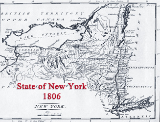
1806 - Southwest Prospect of the City of New York, Walter M. Aikman
1807 - Plan of New York, from log book kept by Major Kirkham
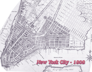
1808 - Map of New York City by David Longworth, Valentine's Manual
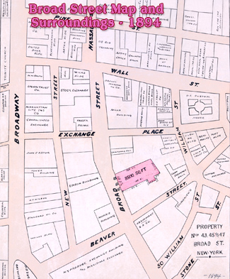
1811 - Tip of Manhattan - Commissioners’ Plan
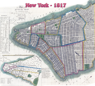
1817 - Map of City of New York, David Longworth's Explanatory Map
1823 - New York from Heights Near Brooklyn by John Hill after William Guy Wall
1823 - New York from Governors Island by John Hill after William Guy Wall
1834 - Panorama of New York, illustration by Robert Burford
1835 - Map of the Great Fire of New York City by George Hayward
1836 - New York from Brooklyn Heights engraved by W.J. Bennett, after John W. Hill
1836 - Map of New York City, by H.S. Tanner (American Traveller)
1837 - Bird's-eye view of Lower Manhattan, Thomas Hornor
1840 - Panoramic view of New York from Hudson River by Robert Havell
1840 - View of New York from Brooklyn, engraved by Thomas Hornor
1844 - Southern Manhattan from East River by Robert Havell
1848 - Lower Broadway, panoramic view from St. Paul’s Church
1848 - New York from Williamsburg, Foreman and Brown
1848 - New York by Edward B. Purcell, from Trinity Church
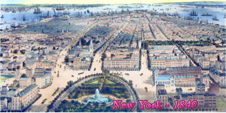
1849 - New York City, looking south from Union Park by J. Bachman
1849 - New York from Brooklyn Heights by Fanny Palmer
1849 - New York from from Weehawken - North River by F. Palmer
1849 - New York from Jersey City, lithographed and published by Nathaniel Currier
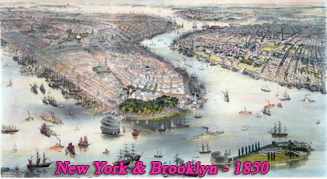
1850 - Bird's eye view of New-York & Brooklyn by John Bachmann
1850s - City of New York & Brooklyn from Williamsburg, J.F. Hesse
1850s - Panoramic View of New York & Brooklyn, William Simpson
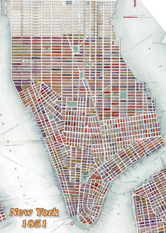
1851 - City of New York, illustration by Heine, J. Kummer & Döpler
1851 - Map New York by John Rapkin, published by John Tallis & Co.
1853 - Brooklyn seen from Trinity Church, Manhattan by John William Hill
1854 - Panorama of Manhattan Island from New Jersey by John Bornet
1855 - Empire City, Birdseye View of New York and Environs
1855 - New York, looking south from 42nd St. Crystal Palace
1855 - Lower Manhattan and East River by Charles Mottram
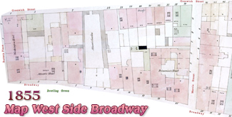
1855 - Broadway, Looking South East from St. Paul's Chapel
1856 - City of New York, illustration by Charles Parsons
1856 - New York & Brooklyn from Williamsburg, by J.W.C. Williams
1859 - New York, Brooklyn, Williamsburg - John Bachmann
1859 - View of New York in a Globe by John Bachmann
1865 - Bird's Eye View of New York and Environs, John Bachmann
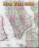
1866 - Plan of New York City, Mitchell's New General Atlas
1866 - Panorama of New York and Vicinity by John Bachmann
1870 - City of New York, bird's eye view by Currier & Ives
1870 - Lower Manhattan, Brooklyn and the Projected Bridge
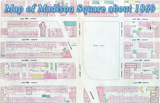
1870 - Business Portion of New York City, below Madison Square
1873 - Panorama of New York, Ferd. Mayer & Sons, lithograph by Geo. Degen
1873 - Bird's-eye View of New York by George Schlegel. Published by Geo. Degen
1873 - Central Park in a Panorama of New York, George Schlegel
1874 - Panorama of the City of New York by John Bachmann
1875 - New York & Brooklyn from Jersey City, Parsons / Atwater
1876 - City of New York, Parsons & Atwater. Published by Currier & Ives
1876 - Manhattan Photographic Panorama by Joshua Beals
1877 - New York and Brooklyn from Jersey City by Parsons & Atwater
1879 - New York, illustration by J. W. Williams. Published by Root & Tinker
1879 - City of Brooklyn by Charles Richard Parsons. Published by Currier & Ives
1880s - City of New York, panorama by L.W. Schmidt from New Jersey
1883 - City of New York, panorama published Currier & Ives
1884 - City of New York, bird's-eye-view, Currier & Ives
1889 - New York, panorama of the City, Parsons & Atwater
1892 - New York City, bird's eye view, by Parsons and Atwater
1896 - Skyline of Manhattan, (East River) by Charles Graham
1897 - Bird's Eye of City of New York, R.W. Rummell / Moses King
1898 - Harbor of the City of New York from the Liberty Island by L. Graham
1899 - Pictorial Description of Broadway, Mail & Express Company
1900 - Manhattan Skyline, from Park Row to Bowling Green


Maps of New York City - 19th Century
|
Copyright © Geographic Guide - Historical maps of NYC. |
State of