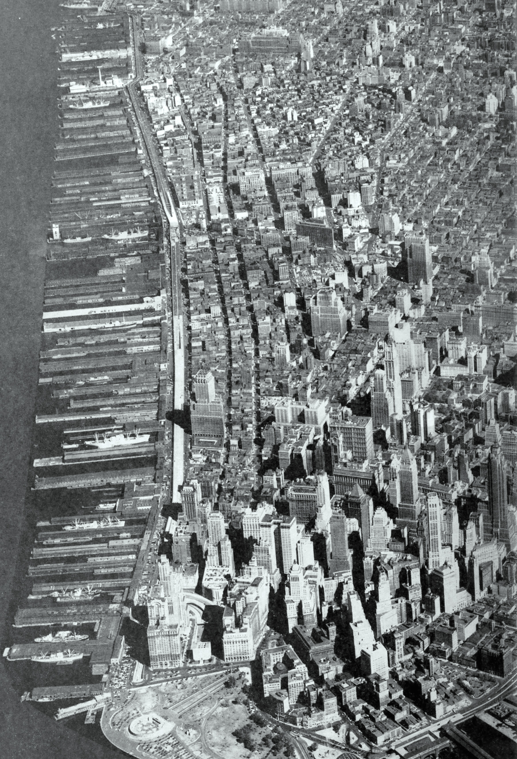
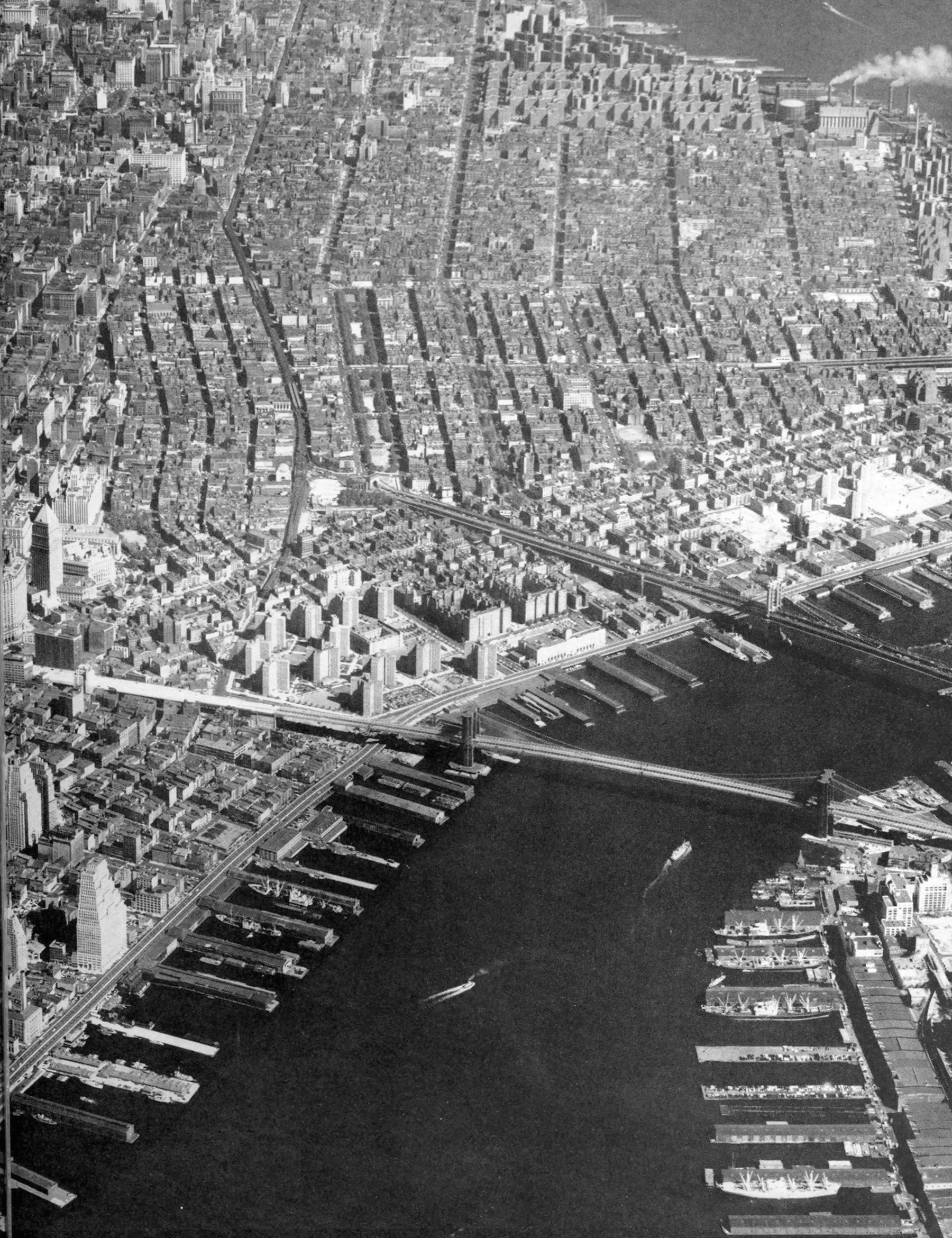
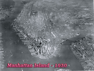
Lower Manhattan 1958
Aerial view the Lower Manhattan in two parts (second part below). Aerial photo by Fairchild Aerial Surveys, Inc., published in "Lower Manhattan: recommended land use, redevelopment areas, traffic improvements - Downtown-Lower Manhattan Association Inc." - 1958.
From the book: «Lower Manhattan today is one of the great world centers, responding to the economic and financial currents, not of a local area, but from the whole United States and abroad. Plans for its growth and development must keep pace with such requirements. The special services performed here for the nation now bring 400,000 people into the area daily.
The area's first industry from the standpoint of employment is an historic one, shipping, which utilizes the services of nearly 50,000 people. Banks and trust companies are next, with more than 45,000 employees. The location of these institutions in the "Financial District" results in part from their close relationship to the stock and commodity exchanges which, in turn, employ more than 25,000 people. Many large corporations whose stocks are listed on the New York exchanges, use the commercial banks as registrars and transfer agents.
Most of the great investment banking houses in the nation are located in the same area, and virtually every important piece of public financing, whether private or governmental, depends upon their services.»
|
Copyright © Geographic Guide - Old Pictures, 20th Century New York City. |
Lower Manhattan 1958