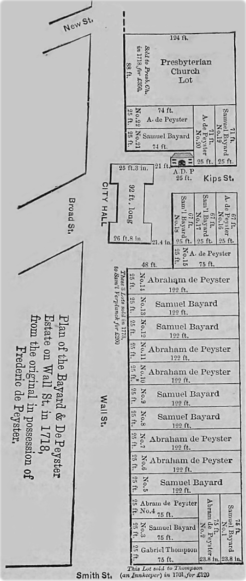
Map of Wall Street in 1718
The map on the right was published in the Real Estate Record and Builders Guide, April 27, 1889 (source: Columbia University Libraries Digital Collections), under the title: Wall Street and the Value of Property.
Text on print: Plan of the Bayard & De Peyster Estate on Wall St. in 1718, from the original in possession of Frederic de Peyster.


Map of Wall Street in 1718
|
Copyright © Geographic Guide - Historical maps of NYC. |