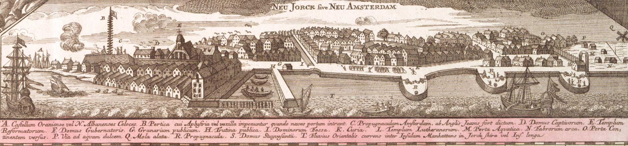
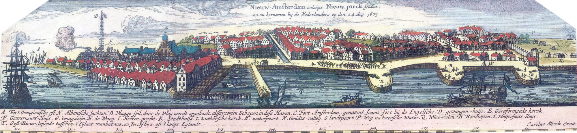
City of New York / New Amsterdam - 1673
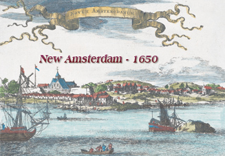
This is an inset, known as "Restitutio View", from an eastern coast map of North America, showing New York (New Amsterdam) at the time it was recaptured by the Dutch on August 24, 1673. Main buildings and places are identified on the bottom of the drawing.
In September of 1664, English forces took control of New Amsterdam and the city was renamed New York. On August 24, 1673, began a brief Dutch reoccupation, but, in 1674, the Treaty of Westminster was signed, giving the official ownership of Manhattan to the English.
Other versions of the drawing above with explanation are shown below. More: Maps of NYC - 17th Century ►
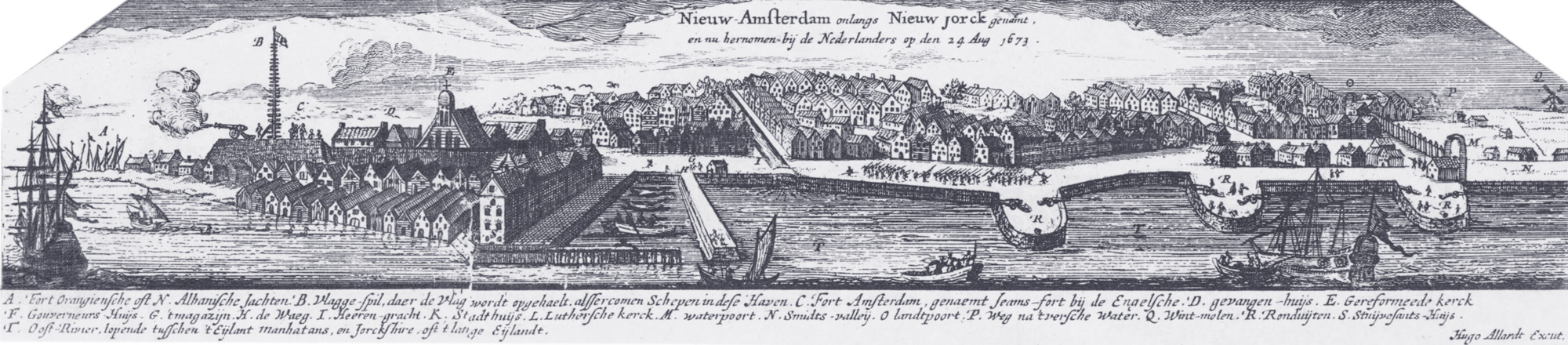
This is an inset from an eastern coast map of North America (the Seutter Map), showing New York (New Amsterdam) depicted in 1673. Original title of the full map: Recens edita totius Novi Belgii, in America septentrionali. It is a later redrawing of the aforementioned inserts, engraved by Matthaeus Seutter (1678-1756) and published about 1730. Source: The New York Public Library.
|
Copyright © Geographic Guide - 17th Century NYC. Historic Maps. |
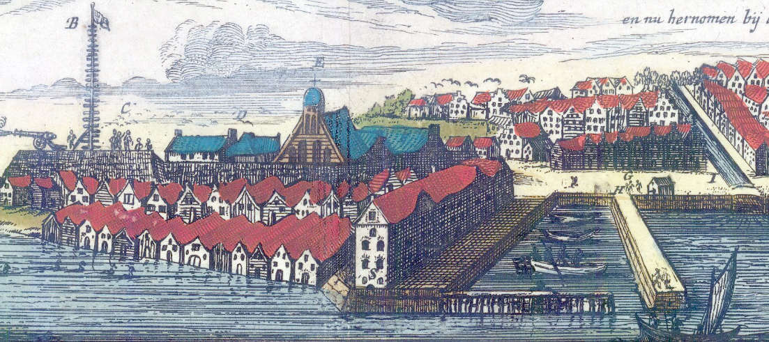
Fragment of Seutter Map.
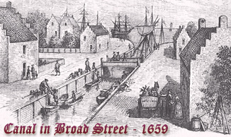
Enlargement of the Fort, with the present Broad Street on the right.
More: Historical maps of New York City ►


City of New York / New Amsterdam - 1673