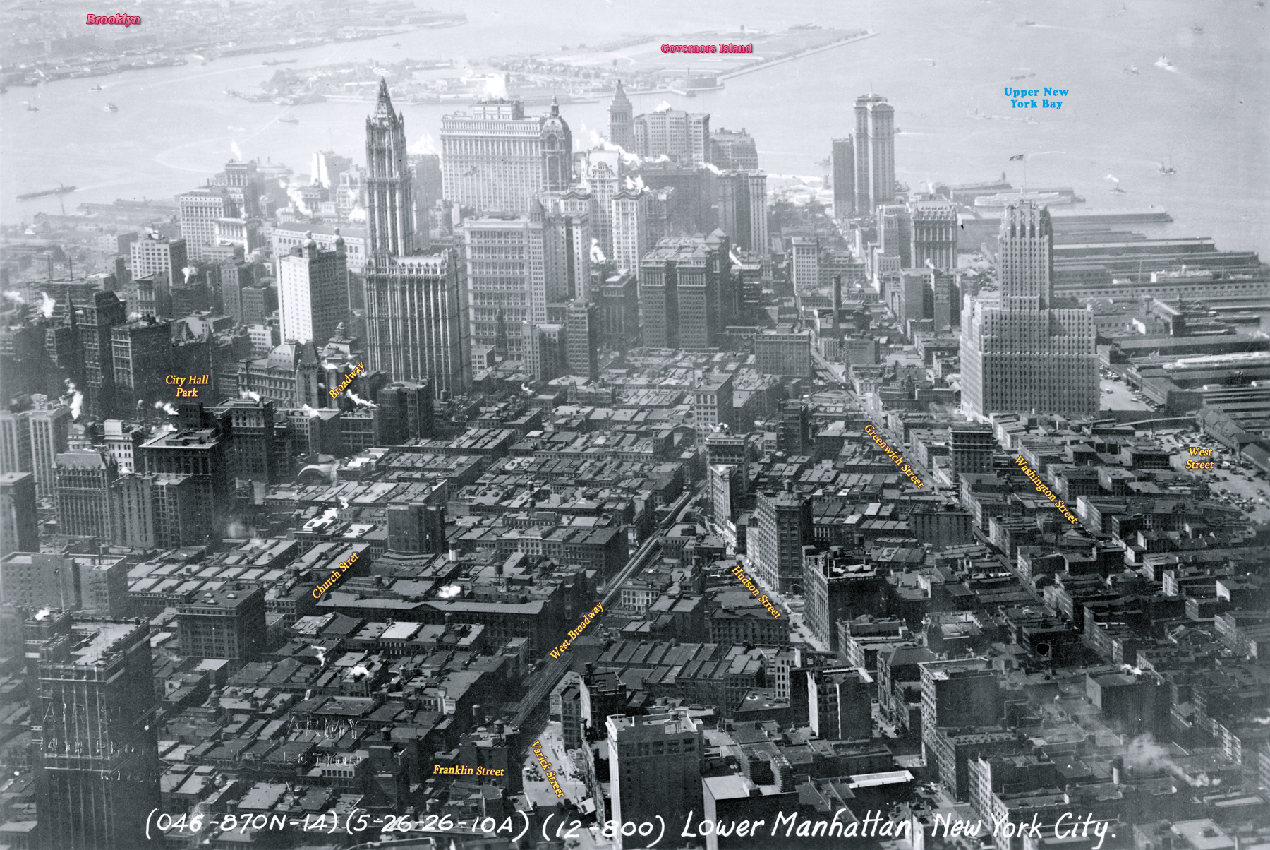
Lower Manhattan from Tribeca - 1926
Aerial photo of Lower Manhattan, looking south toward the Upper New York Bay, from what is now Tribeca neighborhood. Photograph dated May 26, 1926. Source: Records of the Army Air Forces, U.S. National Archives and Records Administration.
The Governors Island and Brooklyn are at the top of the photo. The City Hall Park is on the left and the neo-Gothic Woolworth Building, at 233 Broadway, was then the tallest building in the world. The West Street was then the westernmost street in Manhattan at the time. Later, a landfill (now Battery Park City) replaced the old docks on the Hudson River waterfront.
The region in the foreground is now the Tribeca neighborhood, a syllabic abbreviation of "Triangle Below Canal Street". This "triangle", in fact a quadrilateral, is bounded by Canal Street, West Street, Broadway, and Vesey Street. The name Tribeca was coined in the early 1970s.
100 Barclay Street, completed in 1927.
Lower Manhattan from Tribeca - 1926
|
Copyright © Geographic Guide - 20th Century NYC Skyscrapers. |