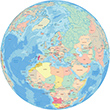
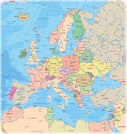
Europe is bordered by the Arctic Ocean to the north, the Atlantic Ocean to the west, and the Mediterranean, Black, and Caspian seas to the south. The southeast boundary with Asia is commonly defined with Ural River, Caucasus Mountains and Black Sea. The Ural Mountains form the natural boundary between Europe and Asia.
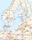
Maps of the European Countries


Cape Roca, in Portugal, the westernmost point of continental Europe (photograph Rui Cunha).
Its strategic position, facing the Atlantic Ocean, in addition to an environment conducive to technological development, in the 15th century, allowed Portugal to become the first global power, in the 16th century, with dominions on four continents.


|
About the Geographic Guide - Travel European Continent. Geography. |
Strandvägen, Stockholm. Midsummer Day, a little past ten in the evening Summer nights in Sweden are magical with the light lingering long into the night.
Henrik Trygg