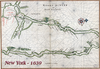
Manatūs (Manhattan) - Map of New Amsterdam Region in 1639 by Joan Vinckeboons
Map of New Amsterdam (present New York City) and region in 1639 by Joan Vinckeboons. Original title: MANATVS gelegen op de Noot [Noort] Rivier. Language: Dutch / Flemish. Source: Library of Congress Geography and Map Division.
Description: Manuscript. Pen-and-ink and watercolor. Covers New York City region. Pictorial map showing buildings and points of interest. Described in Terrae incognitae, v. xvi, 1984. Richard W. Stephenson's The Henry Harrisse collection ... , p. 40; the third volume has binder's title "Manuscript maps of New-Netherland and Manhattan drawn on the spot by Joan Vingboons in 1639."
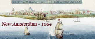
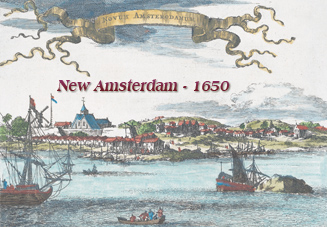
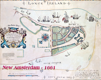
The island of Manhattan was bought by Peter Minuit from the Lenapes for “sixty guilders worth of trade goods”. New Amsterdam was founded by the Dutch West India Company as a trading post oriented towards the lucrative fur trade.
More: Maps of NYC - 17th Century ►

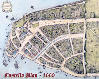
Enlargement of the "Eÿland Manatūs" (Manhattan Island).

More: New York in the 17th Century ►
|
Copyright © Geographic Guide - Maps 17th Century NYC. |