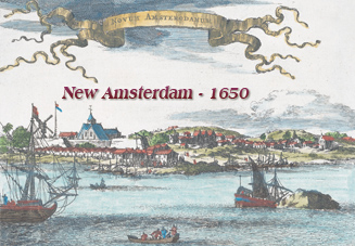
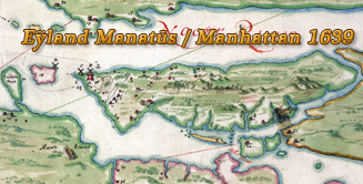
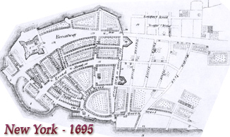
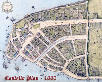
Towne of Mannados or New Amsterdam 1661
Original title: The Duke's Plan - A description of the Towne of Mannados or New Amsterdam : as it was in September 1661, lying in latitude 40 de: and 40 m:, anno Domini 1664.
Named for James, Duke of York. Named the "Duke's Plan" by George H. Moore, librarian at the New York Historical Society, who re-discovered the map in the collections of the British Museum in 1858. Likely copied from a 1661 survey by Jacques Cortelyou. Produced by an anonymous artist of the Thames School of mapmakers.
Published: N.Y. : Geo. Hayward, lith. for D.T. Valentine's Manual, 1859. Fac-simile of a map published in 1664. Limited Edition Art Series issued jointly by the New York Public Library and WNET-Channel 13. Facsimile of facsimile of ms. in the library of the British Museum. Source: New York Public Library.
Text on print by George H. Moore: «In collecting materials for a Catalogue of the Maps and Charts, etc. in the Library of New-York Historical Society, I discovered that the M.S., of which this is a fac-simile, exists in the Geographical and Topographical Collection, belonging to the King's Library in the British Museum. As it seems to have escaped attention hitherto, I have ventured to claim the right of discovery - and to name it "The Duke's Plan." New York. December, 1858.»
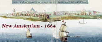
Below, the citadel enlarged and inverted.
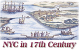
More: Maps of NYC - 17th Century ►
More: New York in the 17th Century ►

|
Copyright © Geographic Guide - 17th Century NYC. Historic Maps |
Towne of Mannados or New Amsterdam 1661