
Maps of New York City - 18th Century
Notable maps were made in the 18th century, based on actual surveys by James Lyne, David Grim, Francis W. Maerschalck, Bernard Ratzer, John Montrésor, Gerard Bancker, Major Holland, Claude Joseph Sauthier and others. Land surveys in the City of New York were intensified during the 1770s, especially during the Revolutionary War (1775–83). Broadway was the main north–south artery of the City.
With the independence, New York was established as the capital of the new country, the United States of America. In 1789, George Washington was sworn in as the first president of the nation. New York also hosted the first meeting of Congress and the first sessions of the Supreme Court. In 1790, the nation's capital was transferred to Philadelphia.
More maps and panoramic views of NYC:
• Maps of NYC - 17th Century ►
• Maps of NYC - 19th Century ►
• Maps of NYC - 20th Century ►
Historical Maps and Panoramas of NYC - 18th Century
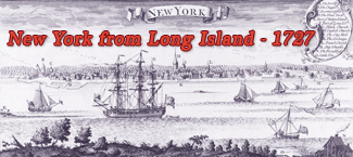
1727 - New York from Long Island by Henry Popple
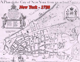
1728 (printed), about 1730 - Plan of New York surveyed by James Lyne
1729 (printed), about 1730 - Plan of New York surveyed by James Lyne
1730 with additions after 1748 - Plan of New York surveyed by James, manuscript
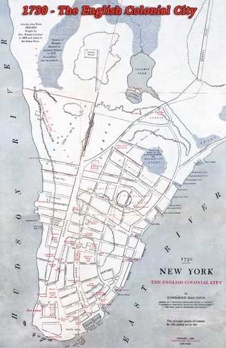
1730 - New York, the English Colonial City, by Townsend MacCoun issued in 1909
1730 (year depicted) - Map of New York by John Carwitham, issued about 1735
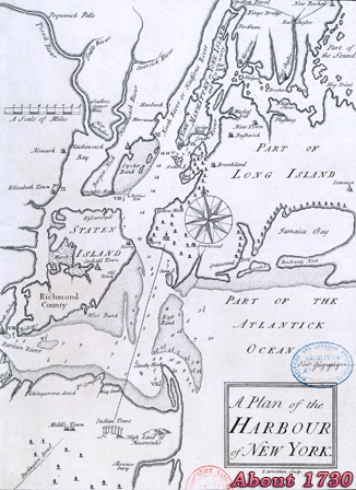
1730 (year depicted) - Plan of the Harbour of New York by John Carwitham
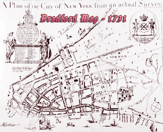
1731 - Bradford Map, surveyed by James Lyne about 1730
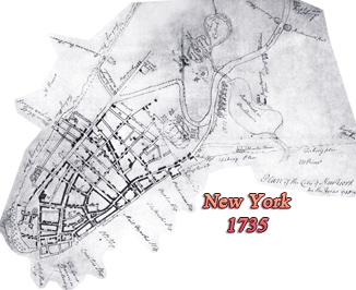
1735 - Plan of the City of New York, manuscript owned by Phelps Stokes
1736 - View of Fort George with the City of New York, John Carwitham
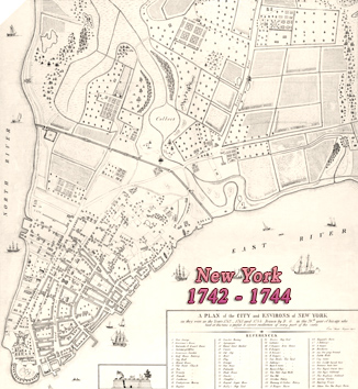
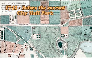
1742 / 1744 - Plan of New York, made in recollection by David Grim
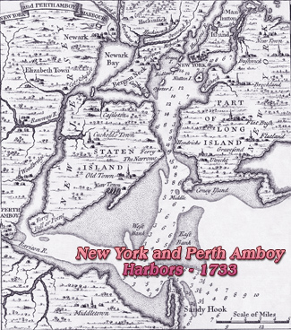
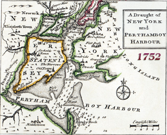
1752 - New York and Perthamboy Harbour, by Emanuel Bowen
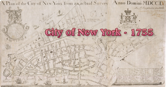
1755 - Plan of the City of New York, by Maerschalck / Duyckinck
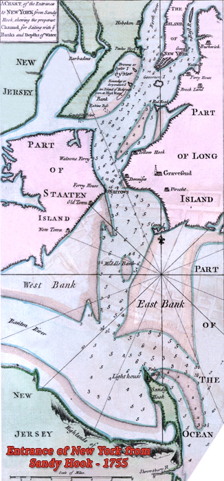
1755 - Map of Entrance of New York from Sandy Hook, by John Montrésor
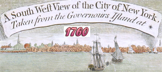
1760 - View of the City of New York from the Governors Island
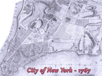
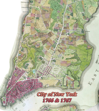
1766 / 1767 - Plan of City of New York by Bernard Ratzer, owned by George III
1767 - Plan of City of New York by Bernard Ratzer (written "Ratzen")
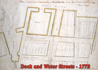
1772 - Dock and Water Streets, by Gerard Bancker City Surveyor
1773 - View of New York from Northwest, from Atlantic Neptune
1774 - Plan of the Ground Contiguous to the Poor House by Gerard Bancker
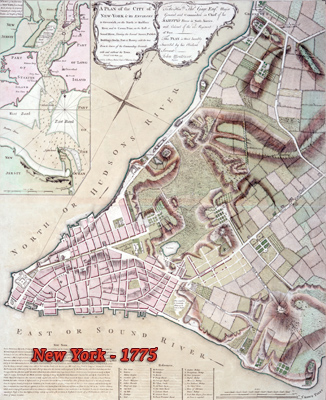
1775 - Plan of the City of New-York & Environs, John Montrésor
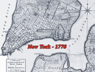
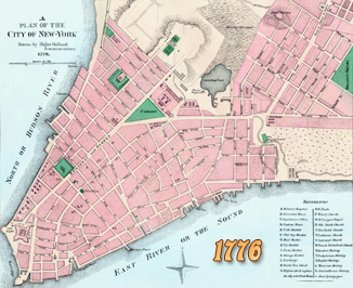
1776 - Plan of the city and environs of New York by John Hinton
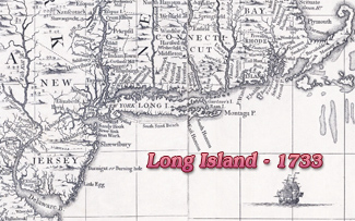
1776 - New York Island, part of Long Island, Staten I. & east NJ
1776 - Plan of the City of New York by Major Holland, Surveyor General
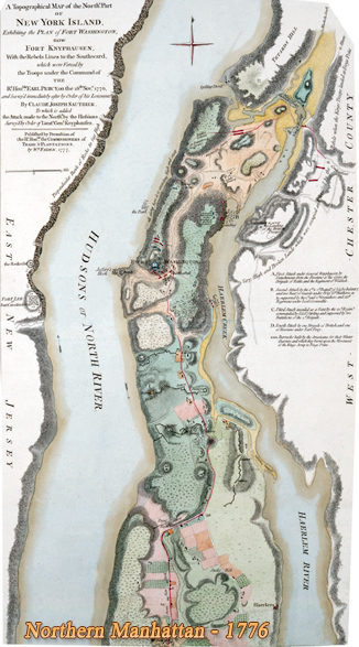
1776 - Topographical Map of Northern Manhattan, C.J. Sauthier
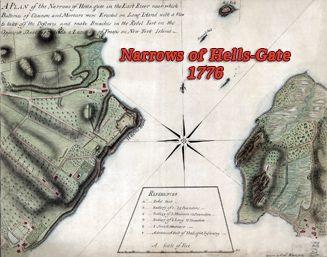
1776 - Narrows of Hells-Gate in the East River, by Charles Blaskowitz
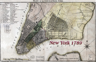
1789 - Plan of the City of New York, by John McComb and Cornelius Tiebout
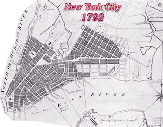
1792 - Plan of City of New York by Cornelius Tiebout
1793 - New York Harbor skyline, A. Robertson
1798 - View of New York from Brooklyn Heights, by Saint-Mémin
1799 - Goerck-Mangin Map of New York City, published in 1803
1800 - Skyline of New York from Long Island by John Wood
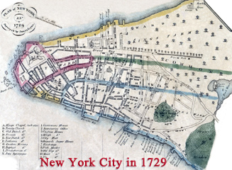
Based on James Lyne's survey.


Plan of New York Island, with part of Long Island, Staten Island & east New Jersey, with disposition of both the armies, British and American.


Part of map by John Montrésor.
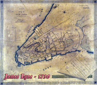
The Manuscript Plan, Survey by James Lyne.


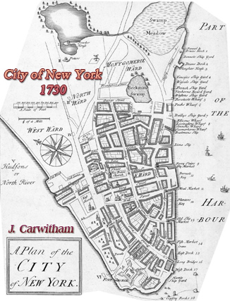
Published alongside the Plan above.


Maps of New York City - 18th Century
|
Copyright © Geographic Guide - Historical Maps and Skylines of NYC. |
State of