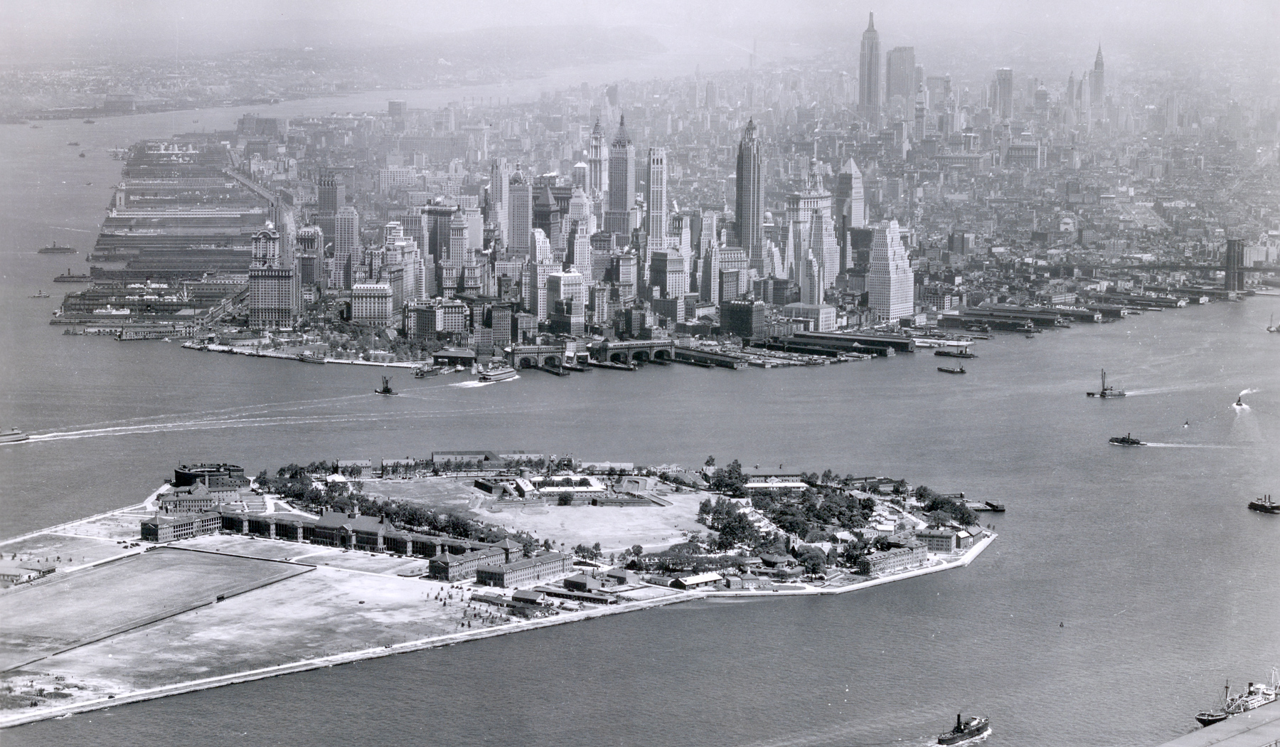
Manhattan and Governors Island - 1938
Aerial view the Manhattan, with Governors Island in the foreground. Photo dated May 31, 1938. Text on print: Airscapes - New York City. Neg. rec'd from Major G.W. Goddard - 5/31/38. Taken during May Maneuvers in Eastern U.S. Source: Records of the Army Air Forces.
We can clearly see skyscrapers in two distinct areas in Midtown and Lower Manhattan. Most of these skyscrapers, including Chrysler and the Empire States Building (then the tallest in the world), were built until the early 1930s, when the Great Depression affected everyone. Battery Park is in the foreground and Hudson River is on the left.
In the 17th century, Governors Island was an early Dutch settlement. Later it became a residence for British governors and part of the defense system of New York.
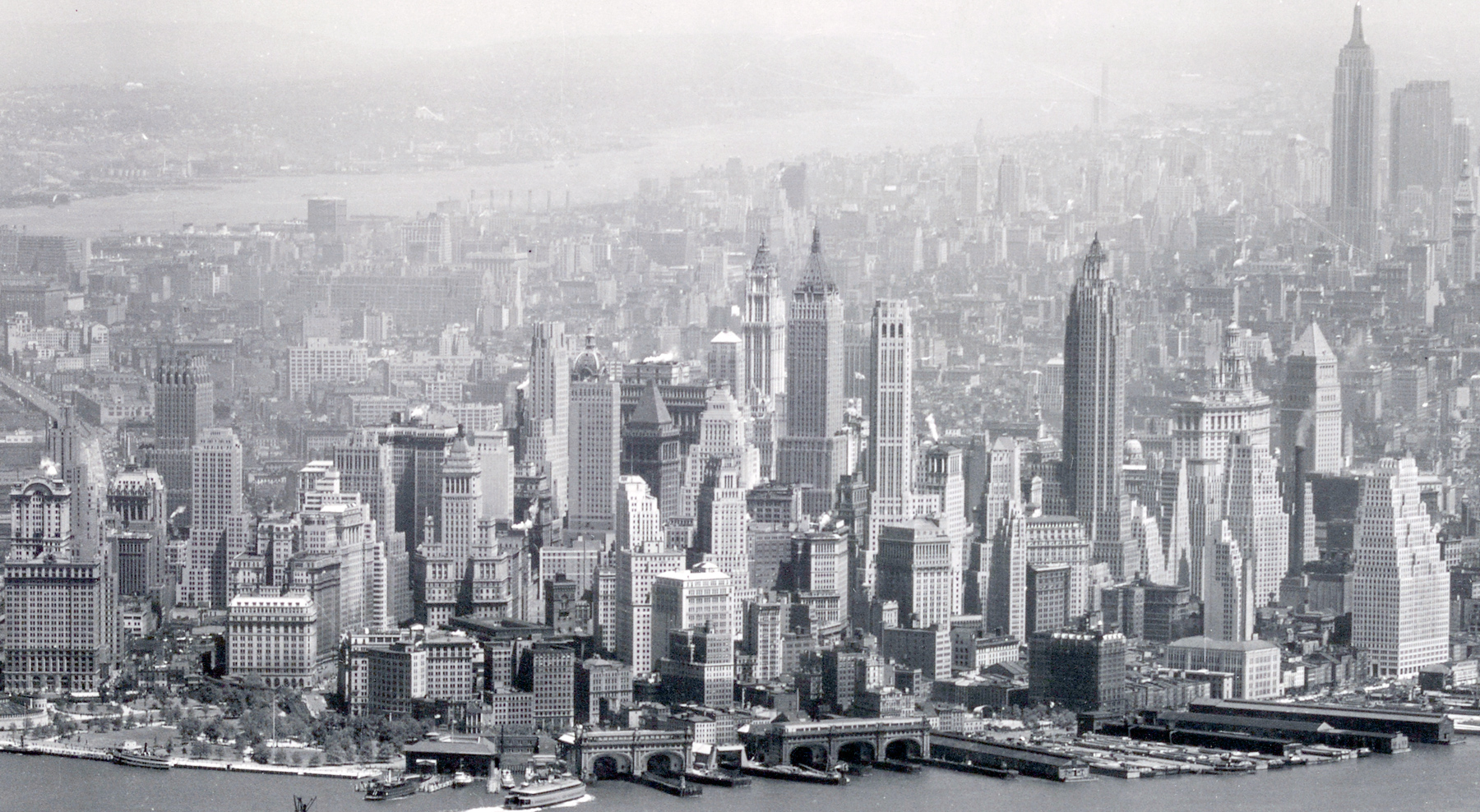
Below, enlargement of skyscrapers of Lower Manhattan.
More: 20th Century Skylines of NYC ►
|
Copyright © Geographic Guide - Old Pictures, 20th Century New York City. |
Manhattan and Governors Island - 1938